Area Overview for B45 9WG
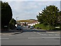
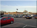
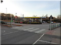
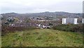
Photos of B45 9WG


Area Information
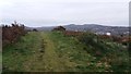
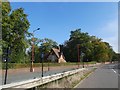
Living in B45 9WG means being part of a small, residential postcode area in the south-west of Birmingham, England. With a population of 2,282, this cluster of homes sits within Frankley Great Park, a suburban ward bordering Waseley Country Park and the Lickey Hills. The area’s character stems from its post-war development, originally designed as a planned community to rehouse residents displaced by inner-city redevelopment. Today, it is governed by the New Frankley in Birmingham Parish Council, a hyper-local body established in 2000 to manage community needs. The area’s proximity to natural spaces like Waseley Country Park offers residents a blend of urban convenience and greenery. Daily life here is defined by a quiet, residential atmosphere, with local amenities and transport links connecting to Birmingham’s broader network. While the area is small, its strategic location near rail stations and major roads ensures accessibility to the city’s employment hubs and cultural centres.
- Area Type
- Postcode
- Area Size
- Not available
- Population
- 2282
- Population Density
- 2835 people/km²
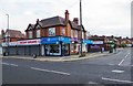
The property market in B45 9WG is characterised by a high rate of home ownership (74%), with houses making up the predominant accommodation type. This indicates a suburban, family-oriented area where many residents own their homes rather than rent. The presence of houses suggests a mix of semi-detached and detached properties, typical of post-war housing developments. Given the small size of the postcode area, the housing stock is likely concentrated within a limited geographic footprint, meaning buyers should consider the immediate surroundings for more options. The high home ownership rate also implies that the area is not a rental hotspot, which may appeal to those seeking long-term stability. However, the limited number of properties within B45 9WG itself means that prospective buyers may need to look beyond the postcode to find additional listings. The mix of owner-occupied homes and the area’s suburban character makes it suitable for families or individuals seeking a quieter, established residential environment.
House Prices in B45 9WG
No properties found in this postcode.
Energy Efficiency in B45 9WG
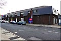
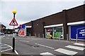
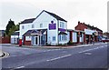
Residents of B45 9WG enjoy a range of local amenities within practical reach, including five retail outlets such as Morrisons Rubery, Tesco Birmingham, and Farmfoods Rubery. These shops provide everyday necessities, reducing the need for long trips to larger shopping centres. The area’s proximity to Waseley Country Park and the Lickey Hills offers opportunities for outdoor recreation, walking, and relaxation. The New Frankley in Birmingham Parish Council fosters a sense of community, with local governance addressing residents’ needs directly. The presence of rail stations and the Edgbaston Village metro station ensures easy access to Birmingham’s cultural and commercial hubs. The suburban character of the area, combined with its mix of shops, green spaces, and transport links, creates a balanced lifestyle that caters to both daily convenience and leisure.
Amenities
Schools
Residents of B45 9WG have access to two schools within practical reach: Rubery Nursery School, which provides early years education, and Colmers School and Sixth Form College, a primary school with an Ofsted rating of satisfactory. The presence of a nursery ensures that young children can attend local education from an early age, while Colmers School offers primary-level schooling. The satisfactory Ofsted rating for Colmers indicates that the school meets acceptable standards but may not excel in all areas compared to higher-rated institutions. For families requiring secondary education, the proximity to Edgbaston Village’s metro station suggests that commuting to larger schools in Birmingham is feasible. The combination of a nursery and a primary school within the area provides a foundation for local education, though parents may need to consider additional options for secondary schooling.
| Rank | School | Type | Entry gender | Ages |
|---|
Explore more schools in this area
Go to Schools tabDemographics
The population of B45 9WG has a median age of 47, with the majority of residents falling within the 30-64 age range. This suggests a community skewed towards adults, likely including families and professionals. Home ownership is high, at 74%, indicating a stable housing market with many long-term residents. The predominant accommodation type is houses, reflecting a suburban layout rather than high-density living. The dominant ethnic group is White, with no specific data on diversity beyond this. While the area research notes a lower proportion of BAME residents compared to Birmingham as a whole, this is not quantified in the provided data. The age profile suggests a mature population, which may influence local services and amenities. The area’s mid-ranking deprivation status, as noted in background research, implies that while resources are available, there may be pockets of economic challenge. However, the high home ownership rate and stable demographics suggest a generally secure, established community.
Household Size
Accommodation Type
Tenure
Ethnic Group
Religion
Household Composition
Age
Household Deprivation
NS-SEC
Explore more demographic insights in this area
Go to Demographics tabPlanning
Planning Constraints
- Flood RiskPremium
- Ramsar Wetland SitesPremium
- Area of Outstanding Natural BeautyPremium
- Protected Nature ReservePremium
- Protected WoodlandPremium