Area Overview for B45 9JQ
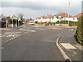
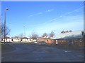
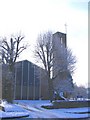
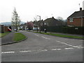
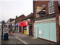
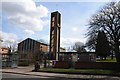
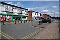
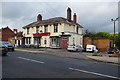
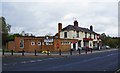
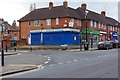
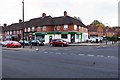
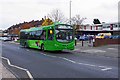
Photos of B45 9JQ
Area Information
B45 9JQ is a small residential postcode area in the Rubery region of Worcestershire, England, with a population of 1,532. It forms part of the broader Rubery area, which stretches into adjacent settlements in Worcestershire and Birmingham. The area’s character is shaped by its historical roots in sandstone quarries and clay pits, with remnants of industrial past visible near Rubery fly-over and in Callowbrook Park. Today, it offers a quiet, low-density living environment, with homes predominantly set in a residential cluster. The median age of residents is 47, suggesting a mature, stable community. Nearby, Callowbrook Park and St Chads Park provide green spaces, while Hollymoor Hospital, a former asylum complex, sits in Northfield. The area is well-connected by rail, with stations at Longbridge, Barnt Green, and Northfield, offering links to Birmingham and beyond. For those seeking a balance between tranquillity and accessibility, B45 9JQ presents a distinct blend of historical heritage and modern convenience.
- Area Type
- Postcode
- Area Size
- Not available
- Population
- 1532
- Population Density
- 3745 people/km²
B45 9JQ is primarily an owner-occupied area, with 73% of homes owned by residents rather than rented. The accommodation type is predominantly houses, which is typical of low-density, suburban settings. This suggests a market where properties are likely to be family homes or long-term residences, rather than investment properties or rental units. The small size of the postcode area means the housing stock is limited, potentially offering fewer options but with a focus on established, well-maintained properties. Buyers should consider the area’s character, which blends residential comfort with proximity to green spaces and rail links. The lack of high-rise or apartment blocks indicates a quieter, more private living environment, suitable for those prioritising stability and space over urban convenience.
House Prices in B45 9JQ
No properties found in this postcode.
Energy Efficiency in B45 9JQ
Residents of B45 9JQ have access to a range of local amenities within practical reach. Retail options include Co-op Rubery, Farmfoods Rubery, and Tesco Birmingham, providing essential shopping and grocery needs. The area’s parks, such as Callowbrook Park and St Chads Park, offer recreational space, with Callowbrook Park’s origins in former clay pits adding a unique historical dimension. The nearby rail stations at Longbridge, Barnt Green, and Northfield enhance connectivity, while the proximity to Hollymoor Hospital reflects the area’s historical ties to healthcare. The blend of green spaces, practical retail, and rail access creates a lifestyle that balances convenience with a sense of community. The presence of parks and local shops ensures daily life remains accessible, with a focus on both leisure and practicality.
Amenities
Schools
| Rank | School | Type | Entry gender | Ages |
|---|
Explore more schools in this area
Go to Schools tabDemographics
The population of B45 9JQ is 1,532, with a median age of 47. The majority of residents fall within the 30–64 age range, indicating a community of mostly middle-aged adults. Home ownership is high at 73%, suggesting a stable, long-term resident base. The predominant accommodation type is houses, reflecting a low-density, suburban character. The predominant ethnic group is White, though no specific diversity statistics are provided. The area’s demographics align with a mature, established population, with few young families or transient residents. This profile suggests a community focused on local amenities, with a strong emphasis on residential stability. The absence of detailed diversity data means the area’s cultural makeup remains less defined, but the high homeownership rate and age profile point to a cohesive, settled environment.
Household Size
Accommodation Type
Tenure
Ethnic Group
Religion
Household Composition
Age
Household Deprivation
NS-SEC
Explore more demographic insights in this area
Go to Demographics tabPlanning
Planning Constraints
- Flood RiskPremium
- Ramsar Wetland SitesPremium
- Area of Outstanding Natural BeautyPremium
- Protected Nature ReservePremium
- Protected WoodlandPremium