Area Overview for B45 9JJ
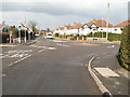
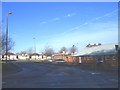
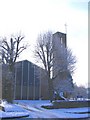
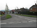
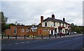
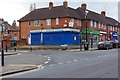
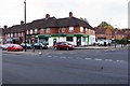
Photos of B45 9JJ

Area Information
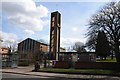
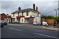
B45 9JJ is a small, tightly knit residential postcode in Worcestershire, England, with a population of 1,532. It forms part of the broader Rubery area, which straddles Worcestershire and Birmingham, blending rural and suburban elements. The area’s history is rooted in 19th-century sandstone quarries and clay pits, now transformed into parks like Callowbrook Park and St Chads Park. Residents here benefit from proximity to both rural tranquillity and urban connectivity. The postcode is served by multiple railway stations, including Longbridge and Barnt Green, linking it to Birmingham and beyond. With a median age of 47 and a strong home ownership rate, B45 9JJ appeals to families and professionals seeking a stable, community-oriented environment. The area’s modest size means it retains a local character, though its location near Birmingham offers access to larger amenities. Living here involves a balance of quiet living and practical access to transport, retail, and green spaces, making it a viable choice for those prioritising safety, affordability, and convenience.
- Area Type
- Postcode
- Area Size
- Not available
- Population
- 1532
- Population Density
- 3745 people/km²
B45 9JJ is a predominantly owner-occupied area, with 73% of homes owned by residents rather than rented. The accommodation type is primarily houses, which is unusual for a small postcode but suggests a mix of semi-detached and detached properties. This housing stock indicates a focus on family homes, with limited rental availability. The high home ownership rate implies a stable market, though the small population size means the area is not a major hub for property investment. Buyers should consider the limited number of properties available, as the area’s size restricts development. Proximity to Birmingham offers access to larger housing markets, but within B45 9JJ itself, the focus is on existing homes rather than new builds. For those seeking a quiet, established home with a strong sense of community, this area may be appealing, though its small scale means it is not ideal for those prioritising a wide range of property choices.
House Prices in B45 9JJ
No properties found in this postcode.
Energy Efficiency in B45 9JJ
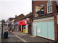
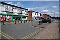
Residents of B45 9JJ have access to a range of local amenities, including retail outlets like Co-op Rubery, Farmfoods Rubery, and Tesco Birmingham, which provide everyday shopping needs. The area’s proximity to railway stations such as Longbridge and Barnt Green enhances connectivity, enabling easy travel to larger urban centres. Nearby parks, including Callowbrook Park (former clay pits) and St Chads Park, offer green spaces for recreation. The historical remnants of sandstone quarries and the nearby Hollymoor Hospital add a layer of local interest. While the postcode itself has limited amenities, its location near Birmingham ensures access to broader leisure, dining, and cultural options. The combination of practical retail, accessible transport, and nearby parks creates a lifestyle that balances convenience with a touch of local character, though residents may need to venture further for more extensive facilities.
Amenities
Schools
| Rank | School | Type | Entry gender | Ages |
|---|
Explore more schools in this area
Go to Schools tabDemographics
The population of B45 9JJ is 1,532, with a median age of 47, indicating a mature community dominated by adults aged 30–64. Home ownership is high at 73%, reflecting a stable, long-term resident base. The area is predominantly White, with no specific data on other ethnic groups provided. The accommodation type is primarily houses, suggesting a mix of family homes and smaller properties. This demographic profile implies a community focused on established living, with limited presence of younger or transient populations. The absence of detailed diversity statistics means the area’s social dynamics remain largely defined by its core demographic. The age range and ownership figures suggest a low turnover of residents, fostering a sense of continuity. However, the lack of data on deprivation or income levels means the area’s economic challenges cannot be assessed, though the high home ownership rate generally correlates with financial stability.
Household Size
Accommodation Type
Tenure
Ethnic Group
Religion
Household Composition
Age
Household Deprivation
NS-SEC
Explore more demographic insights in this area
Go to Demographics tabPlanning
Planning Constraints
- Flood RiskPremium
- Ramsar Wetland SitesPremium
- Area of Outstanding Natural BeautyPremium
- Protected Nature ReservePremium
- Protected WoodlandPremium