Area Overview for B45 9DU
Photos of B45 9DU
Area Information
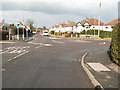
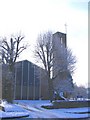
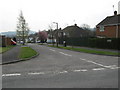
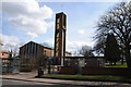
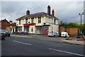
Living in B45 9DU means being part of a small, densely populated residential cluster in England’s West Midlands. With a population of 2,062 and a density of 951 people per square kilometre, this postcode area reflects a compact, community-oriented environment. Situated in the Rubery South Ward of Bromsgrove District, it sits at the intersection of Worcestershire and Birmingham, blending suburban tranquillity with proximity to urban amenities. The area’s history is rooted in sandstone quarries and clay pits, now transformed into parks like Callowbrook Park. Daily life here is shaped by its proximity to rail networks and retail hubs, with Longbridge and Northfield stations offering regular connections. The median age of 47 suggests a stable, established community, with adults aged 30–64 forming the majority. While the area lacks natural constraints like AONBs or protected woodlands, its low flood risk and below-average crime rate of 84/100 make it a practical choice for those prioritising safety and ease of living.
- Area Type
- Postcode
- Area Size
- Not available
- Population
- 2062
- Population Density
- 951 people/km²
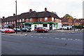
The property market in B45 9DU is characterised by high home ownership (87%) and a predominance of houses. This indicates a residential area where owner-occupation is the norm, rather than a rental market. The focus on houses suggests larger properties compared to flats, which may appeal to families or those seeking space. Given the area’s small size and compact layout, the housing stock is likely limited, with properties concentrated in a specific cluster. Buyers should consider that the market may have fewer options compared to larger towns, but the high home ownership rate suggests a stable demand. The absence of rental data means it’s unclear whether there is a significant buy-to-let presence. For those prioritising space and security, this area offers a mix of established homes in a low-risk environment, though the limited scale of the area may restrict property choices.
House Prices in B45 9DU
No properties found in this postcode.
Energy Efficiency in B45 9DU
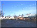
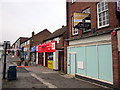
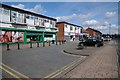
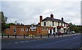
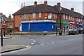
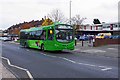
Residents of B45 9DU have access to a range of amenities within practical reach. The area includes five retail venues, such as Co-op Rubery, Farmfoods Rubery, and Tesco Birmingham, offering essential shopping and services. Rail stations like Longbridge and Northfield provide transport links to nearby towns, enhancing connectivity. Locally, Callowbrook Park and St Chads Park offer green spaces for recreation, while remnants of historical sandstone quarries add character to the landscape. The absence of major leisure facilities or dining options means residents may need to travel further for entertainment or dining out. However, the combination of retail outlets and transport links ensures daily needs are met without excessive travel. The area’s small size means amenities are concentrated, creating a compact, convenient lifestyle for those who prioritise accessibility over variety.
Amenities
Schools
The nearest school to B45 9DU is Beaconside Primary and Nursery School, which provides education for younger children. Its Ofsted rating of ‘good’ reflects a satisfactory standard of teaching and facilities, though no further details on curriculum or performance are available. The presence of a primary school within the area is a key consideration for families, as it reduces the need for long commutes. However, the data does not mention secondary schools or further education institutions nearby, which may require residents to travel to adjacent towns like Birmingham or Northfield. The single school listed suggests a focus on primary education, which could be a limitation for families needing comprehensive schooling. Prospective buyers should investigate additional educational options beyond the primary level, as the data does not cover them.
| Rank | School | Type | Entry gender | Ages |
|---|
Explore more schools in this area
Go to Schools tabDemographics
B45 9DU’s population is predominantly composed of adults aged 30–64, with a median age of 47. This suggests a mature, settled community, likely with strong family ties and long-term residency. Home ownership is high at 87%, indicating a stable housing market where most residents live in their own homes rather than renting. The accommodation type is primarily houses, which aligns with the area’s low density and suburban character. The predominant ethnic group is White, though no specific data on diversity or deprivation is provided. The absence of detailed diversity metrics means the community’s composition remains largely unquantified in the data. The age profile and home ownership rates imply a low turnover of residents, fostering a sense of continuity. For buyers, this suggests a neighbourhood where properties are likely to retain value and where local amenities are tailored to long-term residents.
Household Size
Accommodation Type
Tenure
Ethnic Group
Religion
Household Composition
Age
Household Deprivation
NS-SEC
Explore more demographic insights in this area
Go to Demographics tabPlanning
Planning Constraints
- Flood RiskPremium
- Ramsar Wetland SitesPremium
- Area of Outstanding Natural BeautyPremium
- Protected Nature ReservePremium
- Protected WoodlandPremium