Area Overview for B45 8SW
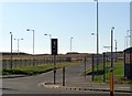
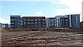
Photos of B45 8SW


Area Information
The postcode B45 8SW refers to a specific residential cluster within the larger Longbridge and West Heath ward in south-west Birmingham. This small area covers just 1265 square metres and contains a population of 1297 residents. You are looking at a compact community that forms part of the most southerly electoral division in the city, situated between Kings Norton, Northfield, and Cofton Hackett. The location sits on traditional heathland historically linked to the Kings Norton manorial lands. While the wider ward boasts a population of over 21,000, this specific cluster offers a contained residential environment. The area transitioned from open farmland to a dormitory suburb following significant post-war housing developments. Large estates built in the 1960s and 1970s replaced earlier prefabricated homes to accommodate returning servicemen and bombing victims. Today, the setting retains the character of a traditional heathland suburb that has evolved over the last century. West Heath originated as a small village centred on Lilley Lane before expanding rapidly after the Second World War. Longbridge House historically served as a headquarters during the Civil War, adding historical depth to the modern streetscape. Living in B45 8SW means residing in a neighbourhood defined by its history and its position as a residential suburb south of the main urban core.
- Area Type
- Postcode
- Area Size
- 1265 m²
- Population
- 1297
- Population Density
- 2050 people/km²
The property market in B45 8SW is uniquely characterised by a strong inclination toward ownership and specific housing formats. With 66 per cent of residents being homeowners, the area stands as a predominantly owner-occupied zone rather than a landlord-heavy rental market. This high rate of ownership suggests that homeowners have established deep roots in the community, contributing to a stable local environment. Flats are the predominant accommodation type found within this postcode, indicating a housing stock designed for smaller household sizes or urban styles often found in suburban post-war estates. The area comprising 1265 square metres for 1297 people implies a high-density living arrangement consistent with other flat-led developments. Buyers looking at homes in B45 8SW should expect a market driven by existing owners rather than speculative developers or long-term tenants. The historical context of post-war estate building explains why flats dominate the local architecture. This profile means the market is resilient to rental fluctuations but less dynamic than areas dominated by buy-to-let investors. The presence of Bournville College of Further Education nearby may attract some student demand, yet the core demographic remains settled adults. The combination of high ownership and flat living creates a distinct economic niche within the wider Birmingham property landscape.
House Prices in B45 8SW
Showing 12 properties
| Address | Type | Beds | Baths | Last Sale Price | Last Sale Date | |
|---|---|---|---|---|---|---|
| Flat 4, 23 Windsor Avenue, Birmingham, B45 8SW | Flat | - | - | - | - | |
| Flat 7, 23 Windsor Avenue, Birmingham, B45 8SW | Flat | - | - | - | - | |
| Flat 2, 23 Windsor Avenue, Birmingham, B45 8SW | Flat | - | - | - | - | |
| Flat 1, 23 Windsor Avenue, Birmingham, B45 8SW | Flat | - | - | - | - | |
| Flat 3, 23 Windsor Avenue, Birmingham, B45 8SW | Flat | - | - | - | - | |
| Flat 6, 23 Windsor Avenue, Birmingham, B45 8SW | Flat | - | - | - | - | |
| Flat 5, 23 Windsor Avenue, Birmingham, B45 8SW | Flat | - | - | - | - | |
| Flat 8, 23 Windsor Avenue, Birmingham, B45 8SW | Flat | - | - | - | - | |
| 23 Windsor Avenue, Birmingham, B45 8SW | Semi-detached | - | - | - | - | |
| Flat 10, 23 Windsor Avenue, Birmingham, B45 8SW | Flat | - | - | - | - |
Energy Efficiency in B45 8SW
Daily life for residents of B45 8SW is supported by a range of amenities located just outside the immediate 1265 square metre boundary. Retail options include M&S Longbridge, Sainsburys Longbridge, and Morrisons Rubery, covering essential shopping needs within a short journey. There are five notable retail venues in this category, providing convenience for everyday purchases. Connectivity to rail is straightforward, with Longbridge Railway Station, Northfield Railway Station, and Barnt Green Railway Station offering five distinct railway services within easy reach. These stations facilitate travel to central Birmingham and surrounding towns. Residents can also access Edgbaston Village via a single metro link for local trips to shops and leisure outlets. The historical context of the area adds to the lifestyle experience, with sites such as West Heath Park and Cofton Park offering green spaces nearby. The decline of the local industry has been replaced by a function as a dormitory area, meaning life revolves around these transport links and the services they provide. Local landmarks like St. Anne's Church and The Man On The Moon pub contribute to the character of the wider neighbourhood. While the immediate postcode is residential, the surrounding Longbridge and West Heath ward provides the necessary infrastructure for a complete lifestyle.
Amenities
Schools
Families considering homes in B45 8SW have access to Bournville College of Further Education as the nearest listed educational institution. This facility operates as a sixth-form college, providing late-stage secondary education to local students. The specific data does not include information regarding state-funded primary or secondary schools immediately adjacent to this postcode, nor does it list Ofsted ratings for the available educational options. Consequently, the nearest named provider focuses on upper-secondary education. The presence of a sixth-form college suggests that older students and young adults passing through this area for post-A-level studies contribute to the local population mix. For younger children, parents would need to look outside the immediate boundaries of this 1265 square metre cluster for nearby primary schools, as none are identified in the current data set. The educational landscape is currently defined by this single named provider. The mix of school types in this specific cluster is limited to further education, which means the area serves as a transit point for students moving from primary education towards higher qualifications. The 1297 residents include adults who likely navigated these educational pathways decades ago.
| Rank | School | Type | Entry gender | Ages |
|---|
Explore more schools in this area
Go to Schools tabDemographics
The community within B45 8SW features a mature population with a median age of 47 years. Adults aged between 30 and 64 years represent the most common age range in this postcode. This demographic profile indicates a neighbourhood dominated by established residents rather than young professionals or students. Homeownership is the prevailing household tenure type, with 66 per cent of residents owning their homes outright. The remaining 34 per cent presumably rent their properties. Flats constitute the predominant accommodation type available in this specific cluster. The local population is predominantly White, reflecting a settlement that has maintained a consistent ethnic composition since its post-war expansion. Given the high rate of homeownership and the mature age profile, the area functions primarily as a stable, owner-occupied residential zone. There is little evidence in the data of a transient population or a large student demographic. The housing stock is largely focused on flat living, which suits the established family households and older residents who make up the bulk of the 1297 residents. The area lacks significant diversity in terms of income or housing tenure, presenting a stereotypical suburban landscape typical of a long-established residential ward in the West Midlands.
Household Size
Accommodation Type
Tenure
Ethnic Group
Religion
Household Composition
Age
Household Deprivation
NS-SEC
Explore more demographic insights in this area
Go to Demographics tabPlanning
Planning Constraints
- Flood RiskPremium
- Ramsar Wetland SitesPremium
- Area of Outstanding Natural BeautyPremium
- Protected Nature ReservePremium
- Protected WoodlandPremium