Area Overview for B45 8JZ
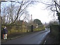
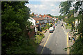
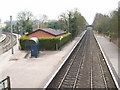
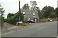
Photos of B45 8JZ


Area Information
Living in B45 8JZ offers a highly specific residential experience defined by its compact scale and dense connectivity. This postcode covers a small residential cluster spanning just 2,918 square metres, a footprint that ensures every resident lives within close proximity to their neighbours. The area accommodates a population of 2,036 people, resulting in a density of 682 people per square kilometre. Such a high density for a limited area creates a neighbourhood where daily interactions are frequent and local community ties are likely strong. You are looking at an environment that rejects sprawl in favour of a concentrated, village-like atmosphere where the boundary between private home and public space is naturally intimate. Residents enjoy the convenience of a defined cluster rather than a sprawling suburb. This small footprint often means less time wasted commuting to local shops or services, as everything essential is typically within walking or short driving distance. The distinct character of B45 8JZ comes from being a self-contained unit rather than a larger ward, providing a sense of place that is immediately apparent once you arrive. It is an area where you know your surroundings by heart, and where the rhythm of daily life moves at a pace dictated by the immediate community rather than distant traffic patterns.
- Area Type
- Postcode
- Area Size
- 2918 m²
- Population
- 2036
- Population Density
- 682 people/km²
The property market surrounding B45 8JZ is characterised by a strong preference for owner-occupancy and detached or semi-detached housing. The data confirms that 85 per cent of homes are owner-occupied, creating a market where leasehold flats and high-street rentals are notably absent from the main housing stock. If you are looking to buy, the vast majority of available homes in B45 8JZ will be houses, aligning with the specific accommodation type listed for the area. This market structure contrasts sharply with large urban centres where rental stock dominates. Most residents have chosen to settle down rather than test the waters with short-term rentals. For a buyer analysing the local market, this means you should expect to find properties that have been tailored over decades for family living rather than modern, transient commuter housing. The high ownership percentage often translates to better-maintained properties, as owners have a permanent stake in the long-term value of their homes. You should not expect to find many purpose-built social housing units or Chain Reaction flats within the immediate cluster. Instead, your search should focus on the established residential cluster that defines the B45 8JZ postcode. This creates a predictable market environment where property values are driven by the quality of the individual house within the stable, owner-led community.
House Prices in B45 8JZ
Showing 4 properties
| Address | Type | Beds | Baths | Last Sale Price | Last Sale Date | |
|---|---|---|---|---|---|---|
| 43 Fiery Hill Road, Barnt Green, B45 8JZ | Semi-detached | 3 | 1 | £614,000 | Mar 2022 | |
| 39 Fiery Hill Road, Barnt Green, B45 8JZ | Semi-detached | 3 | 1 | £475,000 | Aug 2018 | |
| 45 Fiery Hill Road, Barnt Green, B45 8JZ | house | 4 | - | £399,950 | Mar 2014 | |
| 41 Fiery Hill Road, Barnt Green, B45 8JZ | Semi-detached | - | - | £308,000 | Jul 2006 |
Energy Efficiency in B45 8JZ
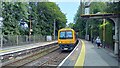
Daily life in B45 8JZ is convenient, with five railway stations and five retail outlets situated within practical reach. Key rail options include Barnt Green Railway Station, Alvechurch Railway Station, and Longbridge Railway Station, offering good links to wider Birmingham and the West Midlands. Your travel options extend beyond trains to local shopping, where Tesco Barnt, Spar Lynwood, and Co-op Alvechurch provide essential groceries and daily necessities. You do not need to venture far for a supermarket trip, a parcel collection, or a quick errand. These notable retailers serve the immediate cluster and surrounding neighbourhoods effectively. The presence of three railway stations ensures that commuting to other parts of the country remains straightforward. Whether you prefer the convenience of a local Spar or the wider range at Co-op Alvechurch, your shopping needs are met easily. This access to both rail and retail creates a self-sufficient lifestyle where you rarely feel the need to travel into the city centre for basic provisions. The combination of good rail links and local high-street options means B45 8JZ functions as a comfortable base for exploring wider areas while retaining the ease of local living.
Amenities
Schools
Families considering B45 8JZ have access to specific educational options, with St Andrew's CofE First School serving as the primary nearby institution. This primary school holds a Good rating from Ofsted, indicating a solid standard of education and pastoral care for younger children. The presence of a Church of England faith school suggests that the local community supports values-based education within this religious tradition. While the data does not list secondary schools immediately adjacent to the cluster, the proximity of St Andrew's CofE First School ensures that younger residents have a reasonable school run without needing to travel great distances across the county. This rating of Good is reputable enough to reassure parents that academic standards are high. For families already living in the area, this school likely serves as a familiar fixture in the landscape. You will find that the mix of school types is limited to this primary provision within the immediate vicinity. The location of St Andrew's CofE First School makes it a central point for community meetings and local events. If you are planning your route from B45 8JZ, the school provides a reliable benchmark for the educational environment available to your household.
| Rank | School | Type | Entry gender | Ages |
|---|
Explore more schools in this area
Go to Schools tabDemographics
The community profile of B45 8JZ reflects a stable, established cư dân base with very high levels of home ownership. Specifically, 85 per cent of the accommodation is owned outright or via mortgage. This figure suggests that most families have been local for a significant period and are investing in their long-term residence. The predominant ethnic group is White, aligning with the broader historical character of the region. The population's age structure shows a median age of 47 years, with the most common age range falling between 30 and 64 years. This demographic skew indicates that the area is particularly suited to mature professionals, grown-up couples, and older families rather than young singles or retirees seeking retirement-specific housing. The accommodation type is exclusively Houses, meaning you will not find flats or apartments within this specific cluster. This houses-only configuration, combined with the high ownership rate, points to a traditional suburban or rural settlement pattern. The absence of young children in the primary age brackets implies that while school-age children reside here, the daily atmosphere might be quieter during weekday evenings compared to areas with a younger demographic. Living here means joining a mature, property-owning community that values stability.
Household Size
Accommodation Type
Tenure
Ethnic Group
Religion
Household Composition
Age
Household Deprivation
NS-SEC
Explore more demographic insights in this area
Go to Demographics tabPlanning
Planning Constraints
- Flood RiskPremium
- Ramsar Wetland SitesPremium
- Area of Outstanding Natural BeautyPremium
- Protected Nature ReservePremium
- Protected WoodlandPremium