Area Overview for B45 8HE
Photos of B45 8HE
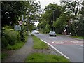
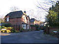
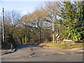
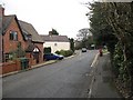

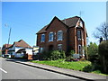
35 photos from this area
Area Information
Key information about the B45 8HE including its size, population, and administrative classification.
- Area Type
- Postcode
- Area Size
- 5.2 hectares
- Population
- 1612
- Population Density
- 262 people/km²
House Prices in B45 8HE
42
Properties
£333,978
Average Sold Price
£90,500
Lowest Price
£560,000
Highest Price
Showing 42 properties
| Address | Type | Beds | Baths | Last Sale Price | Last Sale Date | |
|---|---|---|---|---|---|---|
| 47 Pine Grove, Lickey, B45 8HE | Detached | 4 | - | £492,000 | Jan 2025 | |
| 57 Pine Grove, Lickey, B45 8HE | Detached | 3 | 1 | £390,000 | Dec 2023 | |
| 42 Pine Grove, Lickey, B45 8HE | Detached | 4 | 2 | £440,000 | Jul 2023 | |
| 38 Pine Grove, Lickey, B45 8HE | house | 4 | 1 | £430,000 | Jun 2023 | |
| 18 Pine Grove, Lickey, B45 8HE | Detached | 4 | 1 | £560,000 | Jun 2022 | |
| 35 Pine Grove, Lickey, B45 8HE | Detached | 4 | 2 | £499,000 | Aug 2021 | |
| 20 Pine Grove, Lickey, B45 8HE | Detached | 5 | 3 | £420,000 | Nov 2020 | |
| 24 Pine Grove, Lickey, B45 8HE | Detached | 4 | 2 | £415,000 | Jun 2020 | |
| 11A Pine Grove, Lickey, B45 8HE | house | 4 | 2 | £462,500 | Jan 2020 | |
| 39 Pine Grove, Lickey, B45 8HE | Detached | 4 | 1 | £425,000 | Aug 2019 |
Page 1 of 5
Energy Efficiency in B45 8HE
Amenities
Schools
| Rank | School | Type | Entry gender | Ages |
|---|
Explore more schools in this area
Go to Schools tabDemographics
Household Size
Two person
most common
Accommodation Type
Houses
most common
Tenure
92
majority
Ethnic Group
White
most common
Religion
N/A
most common
Household Composition
N/A
most common
Age
47
median
Adults (30-64 years)
most common
Household Deprivation
N/A
with no deprivation
NS-SEC
56
in Lower managerial occupations
Explore more demographic insights in this area
Go to Demographics tabPlanning
Planning Constraints
- Flood RiskPremium
- Ramsar Wetland SitesPremium
- Area of Outstanding Natural BeautyPremium
- Protected Nature ReservePremium
- Protected WoodlandPremium