Area Overview for B45 8BA
Photos of B45 8BA
Area Information
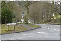
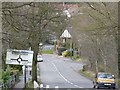
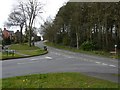
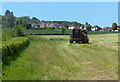
Living in B45 8BA, part of Cofton Hackett in Worcestershire, offers a blend of historical charm and modern convenience. This small civil parish, nestled on the eastern slopes of the Lickey Hills, is home to around 2,435 residents in a compact area of 1,299 acres. The community is largely mature, with a median age of 47 and most residents aged 30–64, reflecting a stable, family-oriented demographic. While the village remains small and scattered, it is poised for growth, with 750 new homes planned on the former Rover East Works site. Historically, the area was shaped by the Austin factory, which once produced aircraft during World War II and later shifted to automotive manufacturing. Today, the landscape is a mix of historic buildings like Cofton Hall and modern developments, with access to nearby towns like Birmingham just 9 miles away. The area’s low crime rate and excellent broadband connectivity make it appealing for those seeking a quiet yet connected lifestyle.
- Area Type
- Postcode
- Area Size
- Not available
- Population
- 2435
- Population Density
- 1949 people/km²
The property market in B45 8BA is characterised by high home ownership (90%) and a focus on houses, which dominate the accommodation type. This suggests a community of long-term residents rather than a transient rental market. The small size of the area means the housing stock is limited, with most properties concentrated in existing residential clusters. However, the planned redevelopment of the former Rover East Works site—adding 750 new dwellings—could alter this dynamic in the coming years. For buyers, this presents both opportunities and challenges: existing homes may hold value due to low supply, but the influx of new properties could affect local prices. The area’s proximity to Birmingham and its transport links may also appeal to commuters, though the small parish size means buyers should consider the immediate surroundings for more options.
House Prices in B45 8BA
No properties found in this postcode.
Energy Efficiency in B45 8BA
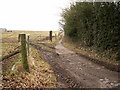
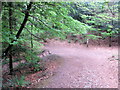
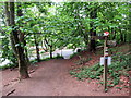
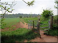
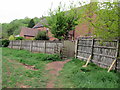
Life in B45 8BA offers a mix of practical amenities and historical attractions. Within reach are shops like Spar Lynwood, M&S Longbridge, and Morrisons Rubery, providing everyday convenience. The nearby rail stations—Longbridge, Barnt Green, and Northfield—connect residents to Birmingham and other regional hubs, enhancing accessibility for shopping, work, or leisure. The area’s natural and cultural assets include the Parish Church of St Michael and All Angels, a 12th-century building with historical significance, and Cofton Hall, a 14th-century structure with an open timbered roof. Cofton Lake and the Worcestershire Way long-distance path offer opportunities for walking and outdoor recreation. These features combine to create a lifestyle that balances local charm with modern practicality, ideal for those who value both heritage and convenience.
Amenities
Schools
| Rank | School | Type | Entry gender | Ages |
|---|
Explore more schools in this area
Go to Schools tabDemographics
The population of B45 8BA is 2,435, with a density of 1,949 people per square kilometre, reflecting a tightly knit community. The median age is 47, with the majority of residents aged 30–64, indicating a mature, established population. Home ownership is high at 90%, with houses the predominant accommodation type, suggesting a stable, long-term resident base. The predominant ethnic group is White, though no specific diversity statistics are provided. This age profile and ownership rate imply a community focused on family living and long-term investment. The absence of detailed deprivation data means the area’s quality of life is likely shaped by its infrastructure and amenities rather than socio-economic challenges. The compact size of the parish ensures a close-knit environment, where daily life is influenced by local traditions and historical sites.
Household Size
Accommodation Type
Tenure
Ethnic Group
Religion
Household Composition
Age
Household Deprivation
NS-SEC
Explore more demographic insights in this area
Go to Demographics tabPlanning
Planning Constraints
- Flood RiskPremium
- Ramsar Wetland SitesPremium
- Area of Outstanding Natural BeautyPremium
- Protected Nature ReservePremium
- Protected WoodlandPremium