Area Overview for B44 9NJ
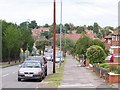
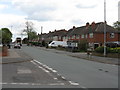
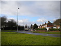
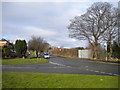
Photos of B44 9NJ


Area Information
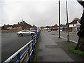
Living in B44 9NJ means inhabiting a small, defined postcode area in the northwest of Birmingham, part of the Perry Barr district. This suburban housing estate, centred on Old Oscott, was developed on former farmland in the 1930s and 1940s. With a population of 1,623, the area is compact but distinct, bordered by Walsall and parts of Great Barr. Its historical roots are deep: Old Oscott has been a Catholic mission site since the 17th century, with ties to figures like John Henry Newman and Oscott College, which moved to New Oscott in 1838. The area’s character is shaped by its past as a rural landscape transformed into a residential cluster. Today, B44 9NJ offers a quiet, semi-rural feel with proximity to nearby towns and transport links. Residents benefit from a mix of local amenities, including schools, retail outlets, and public transport options. The area’s compact size means community life is tightly knit, with a focus on practical living rather than urban sprawl.
- Area Type
- Postcode
- Area Size
- Not available
- Population
- 1623
- Population Density
- 5913 people/km²
The property market in B44 9NJ is characterised by a high proportion of owner-occupied homes, with 52% of residents living in properties they own. The accommodation type is predominantly houses, which is unusual for a small postcode area but reflects the suburban, low-density development of the estate. This suggests a market skewed towards private ownership rather than rental properties. The presence of houses rather than flats or apartments may appeal to buyers seeking larger living spaces or garden access. However, the small size of the area means the housing stock is limited, and buyers may need to consider nearby suburbs for more options. The focus on owner-occupation indicates a community of long-term residents, which could influence property values and local demand. For buyers, this area offers a chance to invest in a stable, established housing stock with a distinct character.
House Prices in B44 9NJ
No properties found in this postcode.
Energy Efficiency in B44 9NJ
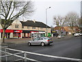
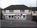
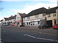
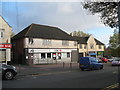
Residents of B44 9NJ have access to a range of amenities within practical reach. Retail options include Morrisons Daily Great Barr 921, Co-op Kingstanding, and Spar, providing everyday shopping needs. Public transport is well-served by five rail stations, such as Hamstead and Sutton Coldfield, and three metro stops, including Winson Green Outer Circle. These connections facilitate travel to nearby towns and cities. Recreational spaces include Aldridge Road Recreation Ground and Kingstanding Circle, offering green space for leisure activities. The area’s historical sites, like Old Oscott (Maryvale), add cultural value, though modern amenities are limited to basic services. The combination of retail, transport, and green space supports a modest lifestyle, though residents may need to travel further for specialist services or entertainment.
Amenities
Schools
The nearest school to B44 9NJ is Kingsland Primary School, a primary school with an Ofsted rating of ‘good’. This school serves the local community and is likely a key consideration for families with young children. The absence of secondary schools in the immediate vicinity means parents may need to look further afield for secondary education, though the primary school’s quality suggests a strong foundation for early learning. The presence of a single primary school indicates a modest educational infrastructure, which may be sufficient for small families but could pose challenges for those requiring a wider range of school options. The ‘good’ rating reflects adequate standards, though it does not provide detailed insight into specific academic outcomes or facilities.
| Rank | School | Type | Entry gender | Ages |
|---|
Explore more schools in this area
Go to Schools tabDemographics
The population of B44 9NJ is 1,623, with a median age of 47. The majority of residents are adults aged 30–64, reflecting a mature, settled community. Home ownership is prevalent, with 52% of households owning their homes. The accommodation type is predominantly houses, indicating a lower density of flats or apartments. The predominant ethnic group is White, though specific diversity figures are not provided. This demographic profile suggests a stable, family-oriented environment with long-term residents. The age range implies a mix of working professionals and retirees, though younger families are less represented. The home ownership rate and housing stock suggest a community focused on long-term residency rather than transient rental markets. This stability may influence local services and amenities, tailored to the needs of middle-aged and older residents.
Household Size
Accommodation Type
Tenure
Ethnic Group
Religion
Household Composition
Age
Household Deprivation
NS-SEC
Explore more demographic insights in this area
Go to Demographics tabPlanning
Planning Constraints
- Flood RiskPremium
- Ramsar Wetland SitesPremium
- Area of Outstanding Natural BeautyPremium
- Protected Nature ReservePremium
- Protected WoodlandPremium