Area Overview for B44 9ET
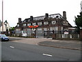
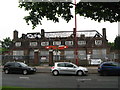
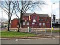
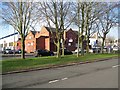
Photos of B44 9ET

Area Information
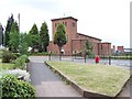
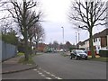
Living in B44 9ET, a small residential cluster in Birmingham’s Perry Barr district, offers a quiet suburban lifestyle within a historically significant area. The postcode covers around 1,522 residents, centred on Old Oscott, a site with deep roots in English Catholicism since the 18th century. The area was once rural farmland, transformed into a housing estate in the 1930s and 1940s. Today, it is bordered by Walsall and parts of Great Barr, with proximity to places like Perry Beeches and Queslett. Its character is defined by its suburban layout, with a mix of older homes and community spaces. Residents benefit from nearby amenities such as rail and metro stations, making it accessible to Birmingham’s broader networks. The area’s history as a Catholic mission site adds a layer of cultural heritage, though modern life here is more about everyday convenience than historical pilgrimage. For those seeking a low-key, established residential environment with practical transport links, B44 9ET provides a compact, self-contained community.
- Area Type
- Postcode
- Area Size
- Not available
- Population
- 1522
- Population Density
- 4625 people/km²
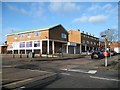
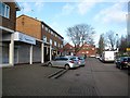
B44 9ET is a housing estate characterised by a 50% home ownership rate, with houses forming the predominant accommodation type. This suggests a mix of owner-occupied and rental properties, though the exact proportion of rentals is not specified. The area’s development in the 1930s and 1940s means most homes are older, likely semi-detached or terraced, typical of post-war suburban housing. As a small postcode area, the property market is limited in scale, with limited scope for new builds or large-scale redevelopment. Buyers should consider the age of properties and potential maintenance needs. The presence of nearby amenities like rail stations and local shops may enhance the appeal of homes here, though the small size of the area means the immediate surroundings are key to assessing property value. For those prioritising a settled, family-friendly environment, B44 9ET offers a modest but functional housing stock.
House Prices in B44 9ET
No properties found in this postcode.
Energy Efficiency in B44 9ET
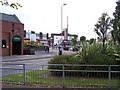
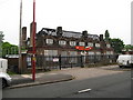
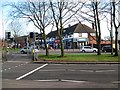
Residents of B44 9ET have access to a range of local amenities within practical reach. The area includes five retail outlets, such as Spar, Co-op Dyas, and Iceland Kingstanding, offering everyday shopping needs. Three rail stations—Hamstead, Perry Barr, and Witton—provide easy access to Birmingham’s transport network, while three metro stations—Soho Benson Road, Winson Green Outer Circle, and Handsworth Booth Street—add further connectivity. Nearby parks and recreational spaces, such as Aldridge Road Recreation Ground and Kingstanding Circle, offer green spaces for leisure. The area also includes Kingstanding Library, a local hub for reading and community activities. The combination of retail, transport, and green spaces creates a convenient lifestyle, blending suburban tranquility with accessibility to urban amenities. For families or commuters, this balance of practicality and local facilities is a key draw.
Amenities
Schools
| Rank | School | Type | Entry gender | Ages |
|---|
Explore more schools in this area
Go to Schools tabDemographics
The population of B44 9ET is 1,522, with a median age of 47, indicating a mature demographic. The most common age range is adults aged 30–64, suggesting a community of settled households rather than a transient population. Home ownership stands at 50%, meaning half of residents own their homes, while the other half are likely to rent. The predominant accommodation type is houses, reflecting a suburban rather than high-density living pattern. The predominant ethnic group is White, though no specific data on diversity or deprivation is provided. This age profile and home ownership rate suggest a stable, family-oriented environment. The absence of detailed diversity metrics means the community’s composition remains largely unquantified beyond the dominant ethnic group. For buyers, this implies a market with established properties and a focus on long-term residency rather than short-term investment.
Household Size
Accommodation Type
Tenure
Ethnic Group
Religion
Household Composition
Age
Household Deprivation
NS-SEC
Explore more demographic insights in this area
Go to Demographics tabPlanning
Planning Constraints
- Flood RiskPremium
- Ramsar Wetland SitesPremium
- Area of Outstanding Natural BeautyPremium
- Protected Nature ReservePremium
- Protected WoodlandPremium