Area Overview for B44 9EE
Photos of B44 9EE


Area Information
B44 9EE is a small, tightly knit postcode area in the northwest of Birmingham, centred on Old Oscott, a historic suburban housing estate developed in the 1930s and 1940s. With a population of 1,591, it sits within the Perry Barr district, bordered by areas like Queslett, Great Barr, and Aldridge. The area’s character is defined by its origins as rural farmland, later transformed into a residential cluster. Its proximity to both urban and green spaces offers a balance of convenience and tranquillity. Residents benefit from nearby schools, rail links, and retail hubs, while the area’s historical ties to Catholicism and education—such as Oscott College—add a distinct cultural layer. Daily life here is shaped by its suburban layout, with homes primarily occupied by families and professionals. The postcode’s compact size means it is a self-contained community, yet it remains within reach of Birmingham’s broader infrastructure, making it appealing for those seeking a quieter lifestyle without sacrificing accessibility.
- Area Type
- Postcode
- Area Size
- Not available
- Population
- 1591
- Population Density
- 1811 people/km²
The property market in B44 9EE is dominated by owner-occupied homes, with 67% of residents living in properties they own. The area is primarily composed of houses rather than flats or apartments, which aligns with its suburban, low-density development. This suggests a focus on family-friendly housing, with larger homes suitable for growing households. Given the postcode’s small size, the housing stock is limited, meaning buyers may need to consider nearby areas for more options. The predominance of owner-occupied properties indicates a stable market, though the lack of rental data means it is unclear whether there is a significant secondary market for tenants. For those seeking a home in B44 9EE, the availability of houses may appeal to buyers prioritising space and long-term investment over short-term rental flexibility.
House Prices in B44 9EE
No properties found in this postcode.
Energy Efficiency in B44 9EE
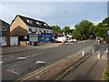
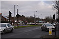
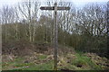
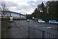
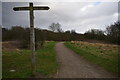
The lifestyle in B44 9EE is shaped by its proximity to retail, transport, and recreational spaces. Nearby shops include Asda Queslett, Spar, and Co-op Dyas, offering everyday essentials within walking distance. The area’s rail and metro stations provide easy access to Birmingham’s wider network, while the suburban setting allows for a slower pace of life. Recreational areas like Aldridge Road Recreation Ground are within the ward, offering green space for leisure. The mix of retail, transport, and open areas supports a practical, community-focused lifestyle. Residents can enjoy convenience without sacrificing the appeal of a quieter, suburban environment, making it suitable for those who value accessibility without urban overcrowding.
Amenities
Schools
Residents of B44 9EE have access to two notable schools. Great Barr School is a primary school, offering education for younger children, while Fortis Academy is an academy with an Ofsted rating of ‘good’. This combination provides families with options between a traditional primary school and a larger, academically focused institution. The presence of both a primary school and an academy suggests a range of educational approaches, though the data does not specify the school catchment areas or student performance metrics. For parents, the proximity of these schools is a key consideration, as it reduces the need for long commutes. However, the absence of further details on school capacity or specialisms means prospective buyers should verify whether their preferred school aligns with their child’s needs.
| Rank | School | Type | Entry gender | Ages |
|---|---|---|---|---|
| 1 | Great Barr School | primary | N/A | N/A |
| 2 | Fortis Academy | academy | N/A | N/A |
Explore more schools in this area
Go to Schools tabDemographics
The population of B44 9EE has a median age of 47, with the majority of residents falling into the 30–64 age range. This suggests a community skewed toward adults, likely including families and professionals. Home ownership is high at 67%, indicating a stable, long-term resident base. The area is predominantly composed of houses, reflecting a suburban character rather than high-density living. The predominant ethnic group is White, though the data does not specify further diversity metrics. This demographic profile implies a mature, established neighbourhood where many residents have lived for years. The absence of specific deprivation data means the area’s quality of life cannot be assessed in terms of economic hardship, but the high home ownership rate and age distribution suggest a relatively secure and cohesive community.
Household Size
Accommodation Type
Tenure
Ethnic Group
Religion
Household Composition
Age
Household Deprivation
NS-SEC
Explore more demographic insights in this area
Go to Demographics tabPlanning
Planning Constraints
- Flood RiskPremium
- Ramsar Wetland SitesPremium
- Area of Outstanding Natural BeautyPremium
- Protected Nature ReservePremium
- Protected WoodlandPremium
- Crime RiskPremium