Area Overview for B44 9BS
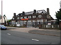
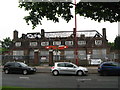
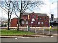
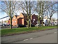
Photos of B44 9BS
Area Information
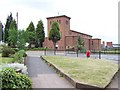
B44 9BS is a small, tightly knit postcode area in northwest Birmingham, nestled within the Perry Barr district. Known locally as Old Oscott, it sits on the edge of former rural farmland, now transformed into a suburban housing estate developed in the 1930s and 1940s. The area’s population of 1,522 reflects a quiet, mature community, with a median age of 47 and a strong presence of adults aged 30–64. Its historical roots as a Catholic mission site and its proximity to landmarks like the Sacred Heart Chapel and Oscott College add a layer of cultural significance. Daily life here balances suburban convenience with easy access to nearby towns such as Walsall and parts of Great Barr. Residents benefit from a mix of practical amenities, including local shops, rail links, and green spaces like Aldridge Road Recreation Ground. The area’s compact size and proximity to Birmingham’s transport networks make it a viable option for those seeking a quieter lifestyle without sacrificing connectivity to the city’s core.
- Area Type
- Postcode
- Area Size
- Not available
- Population
- 1522
- Population Density
- 4625 people/km²
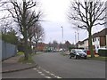
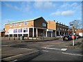
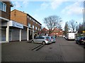
The property market in B44 9BS is defined by its 50% home ownership rate, which indicates a balance between owner-occupied and rental properties. The area is primarily composed of houses, reflecting its suburban character and historical development as a post-war housing estate. This contrasts with urban centres where flats dominate, making B44 9BS a more family-friendly option. Given its small size, the housing stock is limited, and buyers should consider proximity to nearby towns like Perry Barr or Walsall for additional options. The predominance of houses suggests a focus on long-term living rather than short-term investment, though the market may appeal to those seeking a quieter, established community with access to green spaces and local amenities. The area’s compact nature means property values are likely influenced by proximity to transport links and nearby services.
House Prices in B44 9BS
No properties found in this postcode.
Energy Efficiency in B44 9BS
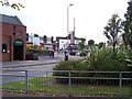
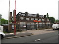
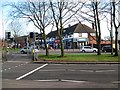
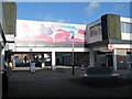
Life in B44 9BS revolves around a blend of practical amenities and suburban tranquillity. Nearby shops include Spar, Iceland Kingstanding, and Co-op Kingstanding, offering everyday essentials. The area’s rail and metro links, such as Hamstead Railway Station and Soho Benson Road, facilitate easy access to Birmingham’s cultural and commercial hubs. Residents can enjoy green spaces like Aldridge Road Recreation Ground, ideal for leisure or family activities. The proximity to Kingstanding Library and historical sites like the Sacred Heart Chapel adds cultural depth. While the area lacks large-scale retail or dining options, its compact size ensures convenience for daily needs. The suburban layout and limited density contribute to a peaceful lifestyle, though those seeking vibrant nightlife or extensive shopping may need to venture to nearby towns.
Amenities
Schools
| Rank | School | Type | Entry gender | Ages |
|---|
Explore more schools in this area
Go to Schools tabDemographics
The community in B44 9BS is predominantly composed of adults aged 30–64, with a median age of 47. This suggests a stable, mature population, likely with established careers and family structures. Home ownership sits at 50%, indicating a balanced mix of owner-occupied and rental properties. The area is characterised by houses rather than flats, reflecting a suburban layout typical of post-war housing estates. The predominant ethnic group is White, though specific diversity data is not detailed in the available records. The absence of significant deprivation indicators implies a generally stable quality of life, though the medium crime risk score of 50/100 suggests residents should remain mindful of standard security measures. The demographic profile aligns with a community that values stability and proximity to essential services, with a focus on family-oriented living.
Household Size
Accommodation Type
Tenure
Ethnic Group
Religion
Household Composition
Age
Household Deprivation
NS-SEC
Explore more demographic insights in this area
Go to Demographics tabPlanning
Planning Constraints
- Flood RiskPremium
- Ramsar Wetland SitesPremium
- Area of Outstanding Natural BeautyPremium
- Protected Nature ReservePremium
- Protected WoodlandPremium