Area Overview for B44 8QS
Photos of B44 8QS
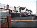
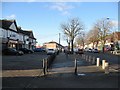
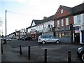
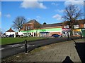
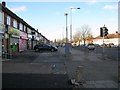
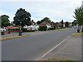

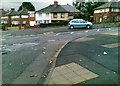
30 photos from this area
Area Information
Key information about the B44 8QS including its size, population, and administrative classification.
- Area Type
- Postcode
- Area Size
- 1.1 hectares
- Population
- 1160
- Population Density
- 5754 people/km²
House Prices in B44 8QS
15
Properties
£166,813
Average Sold Price
£67,000
Lowest Price
£285,000
Highest Price
Showing 15 properties
| Address | Type | Beds | Baths | Last Sale Price | Last Sale Date | |
|---|---|---|---|---|---|---|
| 29 Hawthorn Road, Oscott, Birmingham, B44 8QS | Semi-detached | 3 | 1 | £285,000 | Oct 2024 | |
| 47 Hawthorn Road, Oscott, Birmingham, B44 8QS | house | - | - | £265,000 | Dec 2019 | |
| 25 Hawthorn Road, Oscott, Birmingham, B44 8QS | Semi-detached | 3 | 1 | £105,000 | May 2016 | |
| 49 Hawthorn Road, Oscott, Birmingham, B44 8QS | house | - | - | £187,500 | Jan 2003 | |
| 23 Hawthorn Road, Oscott, Birmingham, B44 8QS | Semi-detached | - | - | £110,000 | Nov 2002 | |
| Sense, 35 Hawthorn Road, Oscott, Birmingham, B44 8QS | Retirement | - | - | £220,000 | Oct 2001 | |
| 41 Hawthorn Road, Oscott, Birmingham, B44 8QS | Detached | - | - | £95,000 | Jan 1999 | |
| 45 Hawthorn Road, Oscott, Birmingham, B44 8QS | Semi-detached | - | - | £67,000 | Feb 1997 | |
| 27 Hawthorn Road, Oscott, Birmingham, B44 8QS | house | 3 | - | - | - | |
| 17 Hawthorn Road, Oscott, Birmingham, B44 8QS | house | - | - | - | - |
Page 1 of 2
Energy Efficiency in B44 8QS
Amenities
Schools
| Rank | School | Type | Entry gender | Ages |
|---|
Explore more schools in this area
Go to Schools tabDemographics
Household Size
Family (3-5 people)
most common
Accommodation Type
Houses
most common
Tenure
48
majority
Ethnic Group
White
most common
Religion
N/A
most common
Household Composition
N/A
most common
Age
47
median
Adults (30-64 years)
most common
Household Deprivation
N/A
with no deprivation
NS-SEC
21
in Lower managerial occupations
Explore more demographic insights in this area
Go to Demographics tabPlanning
Planning Constraints
- Flood RiskPremium
- Ramsar Wetland SitesPremium
- Area of Outstanding Natural BeautyPremium
- Protected Nature ReservePremium
- Protected WoodlandPremium