Area Overview for B44 8AN
Photos of B44 8AN
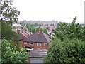
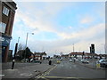
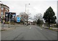


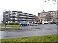
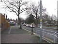
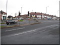
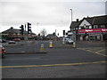
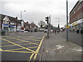

24 photos from this area
Area Information
Key information about the B44 8AN including its size, population, and administrative classification.
- Area Type
- Postcode
- Area Size
- 1.1 hectares
- Population
- 1561
- Population Density
- 1541 people/km²
House Prices in B44 8AN
33
Properties
£158,705
Average Sold Price
£20,000
Lowest Price
£280,000
Highest Price
Showing 33 properties
| Address | Type | Beds | Baths | Last Sale Price | Last Sale Date | |
|---|---|---|---|---|---|---|
| 103 Anstey Road, Birmingham, B44 8AN | Semi-detached | 3 | 1 | £280,000 | Mar 2025 | |
| 67 Anstey Road, Birmingham, B44 8AN | Semi-detached | 3 | 2 | £205,000 | Nov 2022 | |
| 89 Anstey Road, Birmingham, B44 8AN | house | 3 | 1 | £250,000 | Oct 2022 | |
| 71 Anstey Road, Birmingham, B44 8AN | house | - | - | £256,000 | Feb 2022 | |
| 93 Anstey Road, Birmingham, B44 8AN | house | - | - | £220,000 | Aug 2021 | |
| 85 Anstey Road, Birmingham, B44 8AN | Semi-detached | 3 | 1 | £174,000 | Mar 2021 | |
| 97 Anstey Road, Birmingham, B44 8AN | Semi-detached | 3 | 1 | £186,500 | Nov 2020 | |
| 83 Anstey Road, Birmingham, B44 8AN | Semi-detached | 3 | 1 | £208,000 | Nov 2019 | |
| 63 Anstey Road, Birmingham, B44 8AN | Semi-detached | 3 | 1 | £178,000 | Jun 2019 | |
| 69 Anstey Road, Birmingham, B44 8AN | Semi-detached | 3 | 1 | £166,000 | Dec 2018 |
Page 1 of 4
Energy Efficiency in B44 8AN
Amenities
Schools
| Rank | School | Type | Entry gender | Ages |
|---|
Explore more schools in this area
Go to Schools tabDemographics
Household Size
Family (3-5 people)
most common
Accommodation Type
Houses
most common
Tenure
75
majority
Ethnic Group
White
most common
Religion
N/A
most common
Household Composition
N/A
most common
Age
47
median
Adults (30-64 years)
most common
Household Deprivation
N/A
with no deprivation
NS-SEC
24
in Lower managerial occupations
Explore more demographic insights in this area
Go to Demographics tabPlanning
Planning Constraints
- Flood RiskPremium
- Ramsar Wetland SitesPremium
- Area of Outstanding Natural BeautyPremium
- Protected Nature ReservePremium
- Protected WoodlandPremium