Area Overview for B44 0RH
Photos of B44 0RH
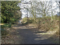
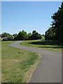
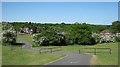
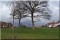
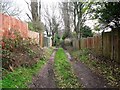
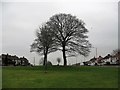
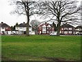
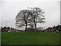
66 photos from this area
Area Information
Key information about the B44 0RH including its size, population, and administrative classification.
- Area Type
- Postcode
- Area Size
- 1.3 hectares
- Population
- 1376
- Population Density
- 7141 people/km²
House Prices in B44 0RH
47
Properties
£121,786
Average Sold Price
£36,000
Lowest Price
£255,000
Highest Price
Showing 47 properties
| Address | Type | Beds | Baths | Last Sale Price | Last Sale Date | |
|---|---|---|---|---|---|---|
| 110 Colindale Road, Birmingham, B44 0RH | Terraced | 3 | 2 | £255,000 | Oct 2025 | |
| 65 Colindale Road, Birmingham, B44 0RH | Terraced | 3 | 1 | £215,000 | Mar 2024 | |
| 68 Colindale Road, Birmingham, B44 0RH | Semi-detached | 3 | 1 | £221,500 | Mar 2023 | |
| 104 Colindale Road, Birmingham, B44 0RH | Terraced | 3 | 1 | £135,000 | Sep 2018 | |
| 75 Colindale Road, Birmingham, B44 0RH | Terraced | 3 | 1 | £105,000 | Jan 2016 | |
| 77 Colindale Road, Birmingham, B44 0RH | house | - | - | £113,500 | Jul 2015 | |
| 47 Colindale Road, Birmingham, B44 0RH | Semi-detached | 3 | - | £93,500 | Jul 2012 | |
| 69 Colindale Road, Birmingham, B44 0RH | house | 3 | - | £103,500 | Mar 2012 | |
| 86 Colindale Road, Birmingham, B44 0RH | house | 2 | - | £90,000 | Mar 2012 | |
| 106 Colindale Road, Birmingham, B44 0RH | house | 3 | 1 | £94,000 | Jul 2009 |
Page 1 of 5
Energy Efficiency in B44 0RH
Amenities
Schools
| Rank | School | Type | Entry gender | Ages |
|---|
Explore more schools in this area
Go to Schools tabDemographics
Household Size
Family (3-5 people)
most common
Accommodation Type
Houses
most common
Tenure
45
majority
Ethnic Group
White
most common
Religion
N/A
most common
Household Composition
N/A
most common
Age
47
median
Adults (30-64 years)
most common
Household Deprivation
N/A
with no deprivation
NS-SEC
15
in Lower managerial occupations
Explore more demographic insights in this area
Go to Demographics tabPlanning
Planning Constraints
- Flood RiskPremium
- Ramsar Wetland SitesPremium
- Area of Outstanding Natural BeautyPremium
- Protected Nature ReservePremium
- Protected WoodlandPremium