Area Overview for B42 2EU
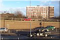
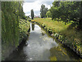
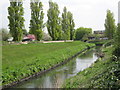
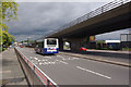
Photos of B42 2EU

Area Information
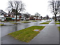
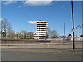
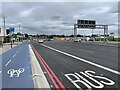
Living in B42 2EU means being part of a small, tightly knit residential cluster in north Birmingham, where history and modernity intersect. The area, known as Perry Barr, has a population of 1,474 residents, with a density of 568 people per square kilometre. Its name traces back to Old English and Celtic roots, reflecting its ancient origins as two manors, Pirio and Barre. Today, it is a suburban suburb of Birmingham, offering a mix of historical landmarks and contemporary living. The area is served by multiple railway stations, including Perry Barr and Witton, linking residents to the city’s transport network. While the population is relatively small, the community is defined by its proximity to Birmingham’s cultural and economic hubs, yet retains a distinct local character. The presence of educational institutions like Eden Boys’ School, rated outstanding by Ofsted, and Prince Albert High School, rated good, underscores the area’s appeal to families. Daily life here balances suburban tranquillity with access to urban amenities, though the high crime risk noted in assessments requires careful consideration.
- Area Type
- Postcode
- Area Size
- Not available
- Population
- 1474
- Population Density
- 568 people/km²
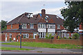
The property market in B42 2EU is characterised by a 39% home ownership rate, with houses being the predominant accommodation type. This indicates a largely owner-occupied area, though the relatively low home ownership percentage suggests a significant portion of the housing stock is rented. The presence of houses rather than flats or apartments aligns with the suburban nature of the postcode, offering larger, more traditional homes. For buyers, this means a focus on individual properties rather than high-density developments. The small size of the area and its immediate surroundings may limit the variety of properties available, but the proximity to Birmingham’s transport links and amenities could enhance the appeal of homes here. Potential buyers should consider the balance between home ownership and rental availability, as well as the impact of local safety assessments on property desirability.
House Prices in B42 2EU
No properties found in this postcode.
Energy Efficiency in B42 2EU
Residents of B42 2EU have access to a range of local amenities within practical reach. The area includes retail options such as Asda Perry, Iceland Perry, and M&S Perry, providing essential shopping and dining choices. Nearby railway stations like Perry Barr and Witton offer convenient transport links, while metro stations such as Soho Benson Road and St Paul’s add to the area’s connectivity. The presence of multiple retail outlets and transport hubs suggests a well-served community, though the absence of specific parks or leisure facilities is not detailed in the data. The local character is defined by its suburban layout, with homes and amenities clustered closely together. While the area may not have large-scale recreational spaces, the proximity to Birmingham’s broader amenities, combined with local retail and transport, supports a lifestyle that balances convenience with suburban tranquillity.
Amenities
Schools
Residents of B42 2EU have access to two notable schools: Eden Boys’ School, Birmingham, which is an academy rated outstanding by Ofsted, and Prince Albert High School, also an academy with a good Ofsted rating. These institutions provide a range of educational options, with Eden Boys’ School offering a high standard of education, as reflected in its top rating. The presence of two academies in the area suggests a competitive educational landscape, which may be a key consideration for families. The mix of school types—both academies—offers flexibility, though the absence of other school types, such as state-maintained schools, is not specified. For parents, the proximity of these schools to homes in B42 2EU could be a significant draw, though the overall quality of education depends on individual school performance and fit for specific needs.
| Rank | School | Type | Entry gender | Ages |
|---|
Explore more schools in this area
Go to Schools tabDemographics
The community in B42 2EU is predominantly composed of adults aged 30–64, with a median age of 47. This suggests a mature population, likely with established careers and families. Home ownership rates stand at 39%, indicating a mix of owner-occupied properties and rental homes. The accommodation type is primarily houses, reflecting a suburban layout rather than high-density housing. The predominant ethnic group is White, though specific data on diversity or minority representation is not provided. The population density of 568 people per square kilometre implies a compact, closely spaced residential area. While deprivation data is not explicitly mentioned, the 39% home ownership rate may suggest a balance between long-term residents and those in rental properties. The age profile and housing stock suggest a community focused on stability, with families and older adults forming the core demographic.
Household Size
Accommodation Type
Tenure
Ethnic Group
Religion
Household Composition
Age
Household Deprivation
NS-SEC
Explore more demographic insights in this area
Go to Demographics tabPlanning
Planning Constraints
- Flood RiskPremium
- Ramsar Wetland SitesPremium
- Area of Outstanding Natural BeautyPremium
- Protected Nature ReservePremium
- Protected WoodlandPremium