Area Overview for B42 2ER
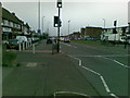
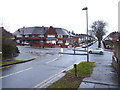
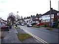
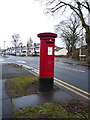
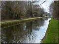
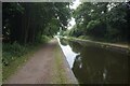
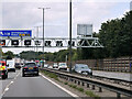
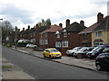
Photos of B42 2ER
Area Information
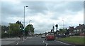
Living in B42 2ER means being part of a small, tightly knit residential cluster in north Birmingham. With a population of 1,756, this area blends suburban calm with proximity to the city’s infrastructure. Historically rooted in the ancient manors of Pirio and Barre, Perry Barr’s name reflects its origins as a pear tree and hilltop settlement. Today, it is a distinct postcode area managed as part of the broader Birmingham metropolitan borough. The community is characterised by its older housing stock, predominantly family homes, and a median age of 47, suggesting a mature, stable population. Daily life here is shaped by proximity to transport networks, including multiple railway and metro stations, and a range of local amenities. While the area lacks major landmarks, its charm lies in its quiet, low-density layout and the practical accessibility of nearby services. For those seeking a balance between suburban tranquillity and urban connectivity, B42 2ER offers a compact, self-contained environment with minimal environmental constraints.
- Area Type
- Postcode
- Area Size
- Not available
- Population
- 1756
- Population Density
- 4128 people/km²
The property market in B42 2ER is dominated by owner-occupied homes, with 76% of properties owned by residents rather than rented. This high home ownership rate suggests a long-term, settled community with minimal turnover. The accommodation type is predominantly houses, which contrasts with areas dominated by flats or apartments. This housing stock reflects a suburban character, offering more space and privacy compared to high-density urban areas. For buyers, this means the market is likely to feature semi-detached or detached homes, which are well-suited to families. However, the small size of the postcode area—covering a residential cluster—means the inventory of properties is limited. Buyers should consider the immediate surrounding areas for a broader selection, though proximity to transport links and amenities remains a key draw. The stability of the market, combined with low environmental risks, makes it an attractive option for those prioritising security and long-term value.
House Prices in B42 2ER
No properties found in this postcode.
Energy Efficiency in B42 2ER
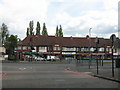
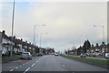
Residents of B42 2ER have access to a range of practical amenities within walking or short driving distance. Local retail options include Co-op Walsall, Lidl Birmingham, and Iceland Great, providing everyday essentials. The area’s transport links extend beyond commuting, with railway stations like Hamstead and Perry Barr offering connections to broader networks. For leisure, the nearby Perry Barr Stadium—though slated for demolition in 2025—once hosted sports and community events, though its current role is unclear. The historical Birmingham Crematorium on Walsall Road adds a layer of local heritage. While parks and green spaces are not explicitly mentioned, the absence of environmental constraints suggests open spaces may be accessible nearby. The combination of retail, transport, and historical sites creates a functional, low-maintenance lifestyle, ideal for those prioritising convenience over large-scale leisure facilities.
Amenities
Schools
| Rank | School | Type | Entry gender | Ages |
|---|
Explore more schools in this area
Go to Schools tabDemographics
The community in B42 2ER is predominantly composed of adults aged 30–64, reflecting a mature demographic profile with a median age of 47. Home ownership is high, at 76%, indicating a stable, long-term resident base. The area’s accommodation is largely made up of houses, suggesting a preference for family-oriented living. The predominant ethnic group is Asian, which influences the cultural fabric of the neighbourhood. This demographic profile aligns with a population of 1,756, a relatively small cluster that fosters close-knit social networks. The absence of specific deprivation data means the quality of life here is inferred from the low environmental risks and high home ownership rates. This suggests residents are likely to have established careers and family ties, contributing to a sense of continuity and community cohesion. The area’s stability is further reinforced by its low crime risk, with a safety score of 82, indicating a secure environment for residents.
Household Size
Accommodation Type
Tenure
Ethnic Group
Religion
Household Composition
Age
Household Deprivation
NS-SEC
Explore more demographic insights in this area
Go to Demographics tabPlanning
Planning Constraints
- Flood RiskPremium
- Ramsar Wetland SitesPremium
- Area of Outstanding Natural BeautyPremium
- Protected Nature ReservePremium
- Protected WoodlandPremium