Area Overview for B42 2AA
Photos of B42 2AA


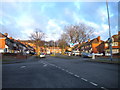
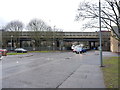
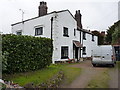
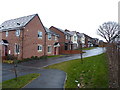

18 photos from this area
Area Information
Key information about the B42 2AA including its size, population, and administrative classification.
- Area Type
- Postcode
- Area Size
- 9943 m²
- Population
- 1885
- Population Density
- 5308 people/km²
House Prices in B42 2AA
34
Properties
£247,975
Average Sold Price
£164,500
Lowest Price
£315,950
Highest Price
Showing 34 properties
| Address | Type | Beds | Baths | Last Sale Price | Last Sale Date | |
|---|---|---|---|---|---|---|
| 187 Booths Lane, Birmingham, B42 2AA | Semi-detached | 2 | 1 | £225,000 | Oct 2024 | |
| 173 Booths Lane, Birmingham, B42 2AA | Semi-detached | 3 | 1 | £295,000 | Nov 2023 | |
| 185 Booths Lane, Birmingham, B42 2AA | Semi-detached | 2 | 1 | £195,000 | Apr 2021 | |
| 201 Booths Lane, Birmingham, B42 2AA | house | - | - | £252,000 | Feb 2021 | |
| 213 Booths Lane, Birmingham, B42 2AA | Detached | 3 | 2 | £240,000 | Apr 2020 | |
| 217 Booths Lane, Birmingham, B42 2AA | Semi-detached | 3 | 1 | £225,000 | Dec 2019 | |
| 151 Booths Lane, Birmingham, B42 2AA | Terraced | 3 | 2 | £221,950 | Nov 2019 | |
| 155 Booths Lane, Birmingham, B42 2AA | house | - | - | £249,950 | Nov 2019 | |
| 157 Booths Lane, Birmingham, B42 2AA | house | - | - | £315,950 | Nov 2019 | |
| 153 Booths Lane, Birmingham, B42 2AA | house | - | - | £249,500 | Oct 2019 |
Page 1 of 4
Energy Efficiency in B42 2AA
Amenities
Schools
| Rank | School | Type | Entry gender | Ages |
|---|
Explore more schools in this area
Go to Schools tabDemographics
Household Size
Family (3-5 people)
most common
Accommodation Type
Houses
most common
Tenure
66
majority
Ethnic Group
White
most common
Religion
N/A
most common
Household Composition
N/A
most common
Age
47
median
Adults (30-64 years)
most common
Household Deprivation
N/A
with no deprivation
NS-SEC
28
in Lower managerial occupations
Explore more demographic insights in this area
Go to Demographics tabPlanning
Planning Constraints
- Flood RiskPremium
- Ramsar Wetland SitesPremium
- Area of Outstanding Natural BeautyPremium
- Protected Nature ReservePremium
- Protected WoodlandPremium