Area Overview for B42 1WH
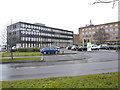
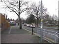
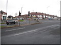
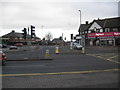
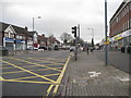
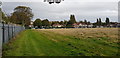
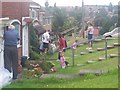
Photos of B42 1WH

Area Information
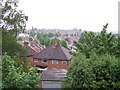
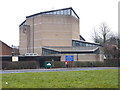
B42 1WH is a small residential postcode in north Birmingham, England, centred on Kingstanding Road and Kings Road. With a population of 1,654, it is a compact area that reflects a blend of historical development and modern suburban living. Originally rural land, the area saw large-scale residential construction from the 1920s, creating a cluster of homes that remain predominantly owner-occupied. The community is characterised by a median age of 47, with most residents falling between 30 and 64 years old. Daily life here is shaped by proximity to local amenities, including shops, schools, and transport links. The area’s history as a planned suburb means it lacks industrial infrastructure, with residents commuting to other parts of Birmingham for work. Despite its small size, B42 1WH offers a mix of practicality and convenience, with nearby rail and metro stations ensuring connectivity. The presence of churches, such as St Luke’s, and historical landmarks like the former Odeon cinema, adds a sense of local identity. For buyers, this area provides a snapshot of mid-20th-century residential planning, with homes that cater to families and individuals seeking a settled, community-focused environment.
- Area Type
- Postcode
- Area Size
- Not available
- Population
- 1654
- Population Density
- 5100 people/km²
The property market in B42 1WH is defined by its high home ownership rate of 66%, indicating that the majority of properties are owner-occupied rather than rented. The accommodation type is predominantly houses, which is consistent with the area’s original design as a suburban residential cluster. This contrasts with areas where flats or apartments dominate, suggesting a more traditional, family-oriented housing stock. Given the small size of the postcode and its limited scope, the market is likely to be niche, with fewer properties available compared to larger urban areas. Buyers should consider that the area’s housing supply is constrained by its size, and opportunities may be limited to existing homes rather than new developments. The prevalence of houses also means that properties may be larger than average, appealing to those seeking space but potentially less so to first-time buyers or those prioritising affordability. The market is unlikely to be highly competitive, but the lack of rental data means it is unclear whether the area functions more as a buyer’s market or one with limited turnover.
House Prices in B42 1WH
No properties found in this postcode.
Energy Efficiency in B42 1WH
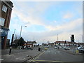
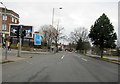
The lifestyle in B42 1WH is shaped by its proximity to a range of amenities within practical reach. Retail options include Tesco Kingstanding, Heron Old, and Co-op Hawthorn, providing everyday shopping convenience. The area’s transport links—five rail stations and five metro stops—ensure easy access to Birmingham’s wider urban fabric, whether for commuting, leisure, or socialising. While the data does not detail parks or recreational spaces, the area’s historical development as a residential suburb suggests the presence of green spaces, though these are not explicitly named. The local character is influenced by its mid-20th-century planning, with churches such as St Luke’s and St Mark contributing to a sense of community. The absence of industrial infrastructure means the area is focused on domestic life, with amenities catering to households rather than commercial activity. This creates a balanced environment where residents can enjoy both the practicality of nearby services and the quietude of a planned residential setting.
Amenities
Schools
The only school explicitly listed near B42 1WH is Goodway Nursery School, which provides early years education. No other schools are detailed in the data, meaning families with children beyond nursery age may need to look beyond the immediate area for primary or secondary education. The absence of additional schools suggests that the area is not a primary destination for families requiring comprehensive schooling, though proximity to larger parts of Birmingham may offer alternatives. For those prioritising nursery education, Goodway’s presence is a practical advantage. However, the lack of data on school quality, Ofsted ratings, or curriculum specifics means that prospective buyers must conduct further research into local educational options. This could be a consideration for families, as the mix of school types—limited to nursery in this case—may not meet the needs of all households.
| Rank | School | Type | Entry gender | Ages |
|---|
Explore more schools in this area
Go to Schools tabDemographics
The demographic profile of B42 1WH reflects a mature, stable population. The median age of 47 indicates a community dominated by adults aged 30 to 64, with 66% of homes owned by residents rather than rented. This suggests a long-term presence of households, many of which may have been established over decades. The predominant accommodation type is houses, aligning with the area’s original design as a residential suburb. The predominant ethnic group is White, though no specific diversity metrics are provided. The absence of data on deprivation or socioeconomic breakdown means the area’s quality of life can only be inferred from ownership rates and age distribution. With no significant age groups under 18 or over 65 noted, the community appears to be largely middle-aged, which may influence local services and amenities. The 66% home ownership rate also implies a degree of stability, with fewer transient residents compared to areas with higher rental occupancy. This profile suggests a neighbourhood where families and long-term residents coexist, shaped by the area’s historical development as a planned residential zone.
Household Size
Accommodation Type
Tenure
Ethnic Group
Religion
Household Composition
Age
Household Deprivation
NS-SEC
Explore more demographic insights in this area
Go to Demographics tabPlanning
Planning Constraints
- Flood RiskPremium
- Ramsar Wetland SitesPremium
- Area of Outstanding Natural BeautyPremium
- Protected Nature ReservePremium
- Protected WoodlandPremium