Area Overview for B42 1WD
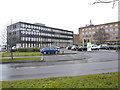
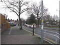
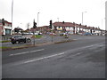
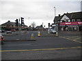
Photos of B42 1WD

Area Information
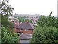
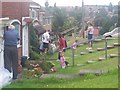
Living in B42 1WD, a small residential cluster in north Birmingham, offers a blend of historical roots and practical modernity. Situated within the Erdington council constituency, this area encompasses Perry Common and Witton Lakes, with its heart at the junction of Kingstanding Road and Kings Road. The postcode covers a compact community of 1,654 residents, shaped by early 20th-century development on former farmland. Originally rural, the area transformed into a residential suburb from 1928, with council housing estates built to accommodate growing populations. Today, B42 1WD retains a quiet, suburban character, with amenities like shops, schools, and transport links integrated into its fabric. The area’s name traces back to King Charles I’s 1642 visit to review troops, a historical touch amid its practical layout. For those seeking a settled, family-oriented environment with access to nearby services, B42 1WD balances historical charm with modern convenience.
- Area Type
- Postcode
- Area Size
- Not available
- Population
- 1654
- Population Density
- 5100 people/km²
The property market in B42 1WD is characterised by a high rate of home ownership (66%) and a predominance of houses. This suggests a residential area where larger, family-oriented properties are the norm, rather than a rental market or high-density housing. The focus on houses may appeal to buyers seeking space and privacy, though the small size of the area means the housing stock is limited. Given the historical development of council housing from the 1920s–1930s, many properties may date back decades, offering a mix of older, well-established homes. Buyers should consider the potential for renovation or modernisation, as well as the area’s proximity to transport links and amenities. The lack of flats or newer developments may make B42 1WD less attractive to those seeking modern or investment properties.
House Prices in B42 1WD
No properties found in this postcode.
Energy Efficiency in B42 1WD
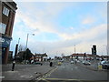
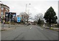
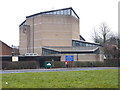
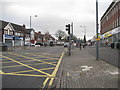
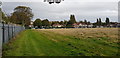
Daily life in B42 1WD is shaped by its proximity to essential amenities. The five retail outlets, including Tesco Kingstanding and Co-op Hawthorn, provide shopping convenience, while nearby parks and green spaces, though not explicitly named, are likely accessible given the area’s historical residential layout. The presence of multiple railway and metro stations ensures easy access to Birmingham’s cultural and commercial hubs. For leisure, the area’s small-scale character may offer a quieter alternative to busier parts of the city, though specific recreational facilities are not detailed in the data. The mix of retail, transport, and historical infrastructure creates a practical, low-key lifestyle, ideal for those valuing convenience without the hustle of urban centres.
Amenities
Schools
The nearest school to B42 1WD is Goodway Nursery School, a nursery providing early education for young children. No primary or secondary schools are listed in the data, which means families may need to look beyond the immediate area for comprehensive schooling. The presence of a nursery suggests some local provision for early years education, but parents should investigate further for secondary education options. The absence of higher-tier schools in the area may influence decisions for families prioritising a range of educational facilities. Those considering B42 1WD should assess the proximity of nearby schools and the availability of transport to larger educational hubs in Birmingham.
| Rank | School | Type | Entry gender | Ages |
|---|
Explore more schools in this area
Go to Schools tabDemographics
The community in B42 1WD is predominantly composed of adults aged 30–64, with a median age of 47. This suggests a mature, stable population, likely with established careers and families. Home ownership is high, at 66%, indicating a strong presence of long-term residents. The accommodation type is primarily houses, reflecting a preference for larger properties over flats. The predominant ethnic group is White, though specific diversity metrics are not provided. The absence of detailed deprivation data means no conclusions can be drawn about economic challenges, but the high home ownership rate and age profile suggest a relatively affluent, settled demographic. For buyers, this implies a community focused on stability, with residents likely prioritising family-friendly living and long-term investment in property.
Household Size
Accommodation Type
Tenure
Ethnic Group
Religion
Household Composition
Age
Household Deprivation
NS-SEC
Explore more demographic insights in this area
Go to Demographics tabPlanning
Planning Constraints
- Flood RiskPremium
- Ramsar Wetland SitesPremium
- Area of Outstanding Natural BeautyPremium
- Protected Nature ReservePremium
- Protected WoodlandPremium