Area Overview for B42 1NL
Photos of B42 1NL

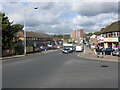
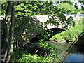
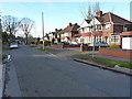
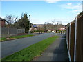
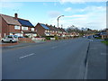
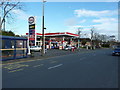
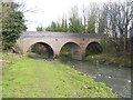
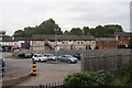
28 photos from this area
Area Information
Key information about the B42 1NL including its size, population, and administrative classification.
- Area Type
- Postcode
- Area Size
- 8429 m²
- Population
- 1472
- Population Density
- 4837 people/km²
House Prices in B42 1NL
27
Properties
£157,996
Average Sold Price
£57,000
Lowest Price
£251,000
Highest Price
Showing 27 properties
| Address | Type | Beds | Baths | Last Sale Price | Last Sale Date | |
|---|---|---|---|---|---|---|
| 403 Rocky Lane, Perry Barr, Birmingham, B42 1NL | Detached | 3 | 1 | £251,000 | Jun 2025 | |
| 385 Rocky Lane, Perry Barr, Birmingham, B42 1NL | Semi-detached | 3 | - | £215,000 | Sep 2024 | |
| 391 Rocky Lane, Perry Barr, Birmingham, B42 1NL | Semi-detached | 3 | 1 | £215,000 | Jun 2023 | |
| 393 Rocky Lane, Perry Barr, Birmingham, B42 1NL | house | - | - | £190,000 | Sep 2021 | |
| 399 Rocky Lane, Perry Barr, Birmingham, B42 1NL | house | - | - | £166,000 | Apr 2018 | |
| 405 Rocky Lane, Perry Barr, Birmingham, B42 1NL | Semi-detached | 3 | 1 | £130,000 | Sep 2017 | |
| 395 Rocky Lane, Perry Barr, Birmingham, B42 1NL | Semi-detached | 3 | 1 | £145,000 | Nov 2016 | |
| 377 Rocky Lane, Perry Barr, Birmingham, B42 1NL | Semi-detached | 3 | - | £130,000 | Oct 2015 | |
| 397 Rocky Lane, Perry Barr, Birmingham, B42 1NL | Semi-detached | 3 | 1 | £100,000 | Sep 2009 | |
| 383 Rocky Lane, Perry Barr, Birmingham, B42 1NL | Terraced | - | - | £155,000 | Jun 2009 |
Page 1 of 3
Energy Efficiency in B42 1NL
Amenities
Schools
| Rank | School | Type | Entry gender | Ages |
|---|
Explore more schools in this area
Go to Schools tabDemographics
Household Size
Family (3-5 people)
most common
Accommodation Type
Houses
most common
Tenure
60
majority
Ethnic Group
White
most common
Religion
N/A
most common
Household Composition
N/A
most common
Age
47
median
Adults (30-64 years)
most common
Household Deprivation
N/A
with no deprivation
NS-SEC
23
in Lower managerial occupations
Explore more demographic insights in this area
Go to Demographics tabPlanning
Planning Constraints
- Flood RiskPremium
- Ramsar Wetland SitesPremium
- Area of Outstanding Natural BeautyPremium
- Protected Nature ReservePremium
- Protected WoodlandPremium