Area Overview for B42 1LD
Photos of B42 1LD

Area Information
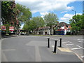
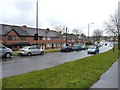
Living in B42 1LD, a small residential postcode in north Birmingham, means being part of a tightly knit community with a distinct historical character. The area, centred on Kingstanding Road and Kings Road, was developed in the 1920s on former farmland, creating a suburban layout with a focus on family living. With a population of 1,936, it is a compact cluster of homes, predominantly owner-occupied, reflecting a stable, middle-aged demographic. The area’s rural origins are evident in its layout, though modern amenities like shops, schools, and transport links now serve its residents. B42 1LD is not a sprawling suburb but a defined cluster, offering a quiet alternative to Birmingham’s busier districts. Its proximity to rail and metro stations ensures connectivity, while its low crime rate and absence of environmental constraints make it appealing for families seeking a balanced lifestyle. The area’s history as a planned residential estate, with no industrial presence, means it retains a residential focus, ideal for those prioritising safety, community, and ease of access to city amenities.
- Area Type
- Postcode
- Area Size
- Not available
- Population
- 1936
- Population Density
- 5220 people/km²
The property market in B42 1LD is dominated by owner-occupied homes, with 82% of properties owned by residents rather than rented. This high ownership rate suggests a stable, long-term demographic, with little turnover in the housing stock. The accommodation type is exclusively houses, which is unusual for modern urban areas and points to a traditional suburban layout. This mix of factors means the area is not a rental market but one focused on private homeownership. For buyers, this implies limited availability of properties for sale, as the small postcode area is unlikely to have a large inventory. However, the proximity to rail and metro stations, combined with the area’s safety and amenities, makes it attractive for those seeking a secure, family-friendly environment. Buyers should consider nearby areas for broader options, as the immediate vicinity of B42 1LD is tightly defined.
House Prices in B42 1LD
No properties found in this postcode.
Energy Efficiency in B42 1LD
Daily life in B42 1LD is shaped by its mix of retail, transport, and community amenities. The area’s retail offerings include Co-op Hawthorn, Heron Old, and Tesco Kingstanding, providing essential shopping options within walking distance. These stores cater to everyday needs, reducing the necessity for long journeys. The proximity to rail and metro stations also means residents can access Birmingham’s cultural and commercial hubs with ease. While the area does not list parks or leisure facilities in its data, its historical churches and suburban layout suggest a quiet, community-oriented lifestyle. The presence of multiple transport links and shopping options ensures convenience without the need for a car, making it suitable for those prioritising accessibility and simplicity in daily routines.
Amenities
Schools
The nearest school to B42 1LD is Hawthorn Primary School, a primary institution with an Ofsted rating of ‘good’. This school serves the local community, providing education for younger children in the area. The absence of secondary schools in the immediate vicinity means families may need to look slightly further afield for secondary education. However, the presence of a well-rated primary school is a significant advantage, offering parents a reliable option for early education. The school’s ‘good’ rating suggests it meets national standards in teaching and facilities, though it does not provide a full range of educational stages. For families prioritising proximity to schools, Hawthorn Primary School is a key asset of the area.
| Rank | A + A* % | School | Type | Entry gender | Ages |
|---|---|---|---|---|---|
| 1 | N/A | Hawthorn Primary School | primary | N/A | N/A |
Explore more schools in this area
Go to Schools tabDemographics
The community in B42 1LD is predominantly middle-aged, with a median age of 47 and the majority of residents falling within the 30-64 age range. This suggests a population skewed towards families and established professionals. Home ownership is high, at 82%, indicating a stable, long-term resident base. The accommodation type is primarily houses, which aligns with the area’s suburban character and lack of high-density housing. The predominant ethnic group is White, reflecting the area’s historical development as a residential estate with limited demographic diversity. While specific data on deprivation is not provided, the high home ownership rate and low crime score imply a relatively affluent and secure environment. The absence of significant rental properties suggests the area is not a hotspot for transient populations, reinforcing its image as a settled, family-oriented community.
Household Size
Accommodation Type
Tenure
Ethnic Group
Religion
Household Composition
Age
Household Deprivation
NS-SEC
Explore more demographic insights in this area
Go to Demographics tabPlanning
Planning Constraints
- Flood RiskLocked
- Ramsar Wetland SitesLocked
- Area of Outstanding Natural BeautyLocked
- Protected Nature ReserveLocked
- Protected WoodlandLocked
- Crime RiskLocked