Area Overview for B42 1JS
Photos of B42 1JS
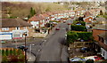
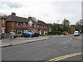
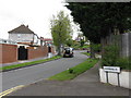
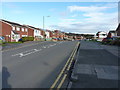
27 photos from this area
Area Information
Key information about the B42 1JS including its size, population, and administrative classification.
- Area Type
- Postcode
- Area Size
- 1.7 hectares
- Population
- 1662
- Population Density
- 7115 people/km²
House Prices in B42 1JS
43
Properties
£159,648
Average Sold Price
£49,950
Lowest Price
£300,000
Highest Price
Showing 43 properties
| Address | Type | Beds | Baths | Last Sale Price | Last Sale Date | |
|---|---|---|---|---|---|---|
| 57 Charnwood Road, Birmingham, B42 1JS | Detached | 3 | 1 | £197,000 | Nov 2025 | |
| 94 Charnwood Road, Birmingham, B42 1JS | Terraced | - | - | £230,000 | Mar 2025 | |
| 102 Charnwood Road, Birmingham, B42 1JS | Semi-detached | 4 | 2 | £300,000 | Dec 2024 | |
| 81 Charnwood Road, Birmingham, B42 1JS | house | - | - | £215,000 | Oct 2024 | |
| 65 Charnwood Road, Birmingham, B42 1JS | Semi-detached | 3 | 1 | £238,000 | Aug 2023 | |
| 56 Charnwood Road, Birmingham, B42 1JS | Semi-detached | 3 | - | £195,000 | Aug 2023 | |
| 74 Charnwood Road, Birmingham, B42 1JS | Semi-detached | 3 | - | £240,000 | Jul 2022 | |
| 58 Charnwood Road, Birmingham, B42 1JS | house | - | - | £166,000 | Oct 2021 | |
| 98 Charnwood Road, Birmingham, B42 1JS | Semi-detached | 3 | 1 | £190,000 | Nov 2019 | |
| 114 Charnwood Road, Birmingham, B42 1JS | house | - | - | £200,000 | Jun 2019 |
Page 1 of 5
Energy Efficiency in B42 1JS
Amenities
Schools
| Rank | School | Type | Entry gender | Ages |
|---|
Explore more schools in this area
Go to Schools tabDemographics
Household Size
Family (3-5 people)
most common
Accommodation Type
Houses
most common
Tenure
78
majority
Ethnic Group
White
most common
Religion
N/A
most common
Household Composition
N/A
most common
Age
47
median
Adults (30-64 years)
most common
Household Deprivation
N/A
with no deprivation
NS-SEC
27
in Lower managerial occupations
Explore more demographic insights in this area
Go to Demographics tabPlanning
Planning Constraints
- Flood RiskPremium
- Ramsar Wetland SitesPremium
- Area of Outstanding Natural BeautyPremium
- Protected Nature ReservePremium
- Protected WoodlandPremium