Area Overview for B42 1EN
Photos of B42 1EN
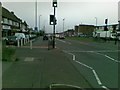
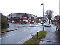
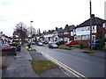
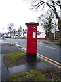
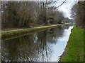


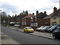
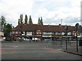
17 photos from this area
Area Information
Key information about the B42 1EN including its size, population, and administrative classification.
- Area Type
- Postcode
- Area Size
- 1.0 hectares
- Population
- 1756
- Population Density
- 4128 people/km²
House Prices in B42 1EN
17
Properties
£179,550
Average Sold Price
£92,000
Lowest Price
£290,000
Highest Price
Showing 17 properties
| Address | Type | Beds | Baths | Last Sale Price | Last Sale Date | |
|---|---|---|---|---|---|---|
| 719 Walsall Road, Perry Barr, Birmingham, B42 1EN | Semi-detached | 3 | 1 | £290,000 | Aug 2024 | |
| 723 Walsall Road, Perry Barr, Birmingham, B42 1EN | Semi-detached | 3 | 1 | £205,500 | Dec 2017 | |
| 739 Walsall Road, Perry Barr, Birmingham, B42 1EN | Semi-detached | 3 | - | £197,000 | May 2015 | |
| 749 Walsall Road, Perry Barr, Birmingham, B42 1EN | house | - | - | £210,000 | May 2011 | |
| 737 Walsall Road, Perry Barr, Birmingham, B42 1EN | Semi-detached | 3 | 1 | £190,000 | Jul 2008 | |
| 733 Walsall Road, Perry Barr, Birmingham, B42 1EN | Terraced | - | - | £183,000 | Apr 2005 | |
| 747 Walsall Road, Perry Barr, Birmingham, B42 1EN | Semi-detached | - | - | £175,000 | Sep 2003 | |
| 743 Walsall Road, Perry Barr, Birmingham, B42 1EN | Semi-detached | - | - | £133,000 | Feb 2003 | |
| 727 Walsall Road, Perry Barr, Birmingham, B42 1EN | house | - | - | £120,000 | Apr 2002 | |
| 725 Walsall Road, Perry Barr, Birmingham, B42 1EN | Terraced | - | - | £92,000 | Jun 2000 |
Page 1 of 2
Energy Efficiency in B42 1EN
Amenities
Schools
| Rank | School | Type | Entry gender | Ages |
|---|
Explore more schools in this area
Go to Schools tabDemographics
Household Size
Family (3-5 people)
most common
Accommodation Type
Houses
most common
Tenure
76
majority
Ethnic Group
asian_total
most common
Religion
N/A
most common
Household Composition
N/A
most common
Age
47
median
Adults (30-64 years)
most common
Household Deprivation
N/A
with no deprivation
NS-SEC
28
in Lower managerial occupations
Explore more demographic insights in this area
Go to Demographics tabPlanning
Planning Constraints
- Flood RiskPremium
- Ramsar Wetland SitesPremium
- Area of Outstanding Natural BeautyPremium
- Protected Nature ReservePremium
- Protected WoodlandPremium