Area Overview for B42 1EE
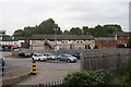
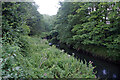
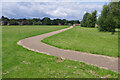
Photos of B42 1EE
Area Information
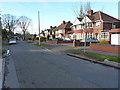
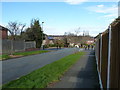
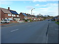
Living in B42 1EE means inhabiting a small, residential cluster within Handsworth Wood, a suburb north of Birmingham City Centre. With a population of 1,592, the area retains a suburban, low-density character marked by large houses on spacious plots. Historically, it was a sought-after retreat for Birmingham’s wealthy in the 19th century, offering a rural escape from industrialisation. Today, its village-like quality persists, with a clear distinction from the more densely populated parts of Handsworth. The area’s legacy of affluence and quiet living remains, supported by its proximity to Birmingham’s core while maintaining a sense of separation. Residents benefit from nearby rail links and a mix of local amenities, though the area’s charm lies in its spacious properties and historical roots. For those seeking a balance between urban accessibility and suburban tranquillity, B42 1EE offers a distinct alternative to Birmingham’s bustling centres.
- Area Type
- Postcode
- Area Size
- Not available
- Population
- 1592
- Population Density
- 5136 people/km²
The property market in B42 1EE is dominated by owner-occupied homes, with 84% of properties owned by residents rather than rented. The accommodation type is exclusively houses, not flats or apartments, reflecting a focus on spacious, low-density housing. This aligns with the area’s historical role as a suburban retreat for Birmingham’s wealthy, where large properties on substantial plots remain the norm. For buyers, this means a market skewed towards family homes and long-term investment, rather than rental opportunities. The small size of the area and its immediate surroundings suggest limited property turnover, making it a niche market for those seeking specific characteristics like space and historical charm. Prospective buyers should consider the area’s proximity to Birmingham’s core, which may influence both property values and lifestyle choices.
House Prices in B42 1EE
No properties found in this postcode.
Energy Efficiency in B42 1EE
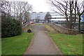
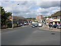
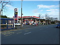
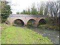
Residents of B42 1EE have access to a range of nearby amenities, including retail outlets such as Lidl Birmingham, Co-op Walsall, and Tesco Great. The area’s rail network includes Perry Barr, Handsworth, and Hawthorns stations, offering direct links to Birmingham and surrounding regions. Locally, Handsworth Park (originally Victoria Park) is a key feature, with formal gardens and historical landmarks like St. Mary’s Church and the Old Town Hall on College Road. These spaces provide leisure, recreation, and a connection to the area’s heritage. The combination of practical retail, transport options, and green spaces creates a lifestyle that balances suburban tranquillity with urban accessibility. The presence of historical sites and parks adds a layer of cultural richness, making daily life both convenient and engaging.
Amenities
Schools
| Rank | School | Type | Entry gender | Ages |
|---|
Explore more schools in this area
Go to Schools tabDemographics
The community in B42 1EE is predominantly middle-aged, with a median age of 47 and the most common age range being adults aged 30–64. Home ownership is high, at 84%, reflecting a stable, long-term resident base. The area is characterised by houses, not flats or apartments, suggesting a focus on family homes and larger properties. The predominant ethnic group is Asian, which shapes the cultural and social fabric of the neighbourhood. While no deprivation data is provided, the high home ownership and age profile indicate a mature, established community with lower turnover. The absence of specific data on income or deprivation means the area’s quality of life must be inferred from its infrastructure and amenities. The demographic profile suggests a place where residents prioritise stability, space, and proximity to services over transient living.
Household Size
Accommodation Type
Tenure
Ethnic Group
Religion
Household Composition
Age
Household Deprivation
NS-SEC
Explore more demographic insights in this area
Go to Demographics tabPlanning
Planning Constraints
- Flood RiskPremium
- Ramsar Wetland SitesPremium
- Area of Outstanding Natural BeautyPremium
- Protected Nature ReservePremium
- Protected WoodlandPremium