Area Overview for B42 1DZ
Photos of B42 1DZ
Area Information
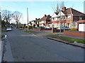
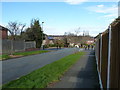
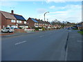
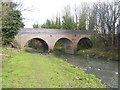
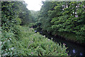
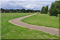
B42 1DZ is a small residential postcode area in England, part of the Handsworth district north of Birmingham City Centre. With a population of 1,737, it is a low-density, suburban cluster characterised by large, spacious properties on substantial plots. Historically, the area was a rural retreat for Birmingham’s wealthy in the 19th century, later evolving into a suburban community with distinct socio-economic boundaries. Today, it retains a village-like quality despite its proximity to urban Birmingham, with a mix of historic and modern infrastructure. The area’s connection to Handsworth Park and its legacy as an evacuation zone during World War II adds to its unique character. Residents benefit from proximity to Birmingham’s core while enjoying a quieter, more residential environment. The area’s appeal lies in its blend of historical significance, suburban tranquillity, and modern amenities, making it a niche choice for those seeking space and a sense of separation from city life.
- Area Type
- Postcode
- Area Size
- Not available
- Population
- 1737
- Population Density
- 3895 people/km²
B42 1DZ is a predominantly owner-occupied area, with 82% of homes owned by residents rather than rented. The accommodation type is exclusively houses, not flats or apartments, which is typical of suburban districts. This suggests a housing stock focused on larger properties, often set on spacious plots. Given the area’s small size and low population density, the market is likely limited in scale but characterised by high-quality, family-friendly homes. The prevalence of houses rather than rental properties indicates a community prioritising permanence and space. For buyers, this means a focus on individual properties rather than investment opportunities, with potential for long-term value retention. The area’s suburban nature and historical appeal to affluent residents further support the notion of a stable, low-turnover market.
House Prices in B42 1DZ
No properties found in this postcode.
Energy Efficiency in B42 1DZ
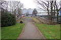
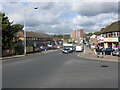
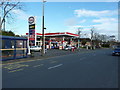
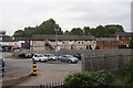
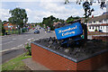
Residents of B42 1DZ have access to a range of amenities within practical reach. Retail options include Lidl Birmingham, Co-op Walsall, and Tesco Great, providing everyday shopping convenience. The area is served by five railway stations—Hamstead, Perry Barr, and Witton—and three metro stations—Handsworth Booth Street, Winson Green Outer Circle, and Soho Benson Road—ensuring frequent public transport options. Nearby, Handsworth Park offers recreational space with historic features such as the Sunken Garden and St. Mary’s Church. The area’s suburban character combines practicality with green spaces, making it suitable for families and individuals seeking a balance between urban accessibility and rural tranquillity. The presence of multiple retail and transport hubs, alongside natural amenities, supports a lifestyle that prioritises convenience without sacrificing quality of life.
Amenities
Schools
| Rank | School | Type | Entry gender | Ages |
|---|
Explore more schools in this area
Go to Schools tabDemographics
The population of B42 1DZ is 1,737, with a median age of 47 and the majority of residents aged 30–64. This suggests a community of middle-aged and older adults, likely including families and long-term residents. Home ownership is high at 82%, indicating stability and a focus on long-term residency. The area is predominantly occupied by houses, not flats, reflecting its suburban nature. The predominant ethnic group is Asian, though specific subgroups are not detailed. The age profile and ownership rates suggest a mature, settled population with limited turnover. The absence of deprivation data means no direct commentary on economic hardship, but the high home ownership and age range imply a relatively stable, middle-income demographic. This profile aligns with the area’s historical role as a suburban retreat, attracting those seeking established, low-density living.
Household Size
Accommodation Type
Tenure
Ethnic Group
Religion
Household Composition
Age
Household Deprivation
NS-SEC
Explore more demographic insights in this area
Go to Demographics tabPlanning
Planning Constraints
- Flood RiskPremium
- Ramsar Wetland SitesPremium
- Area of Outstanding Natural BeautyPremium
- Protected Nature ReservePremium
- Protected WoodlandPremium