Area Overview for B42 1DS
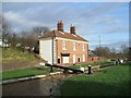
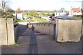
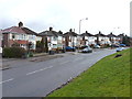
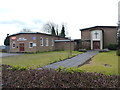
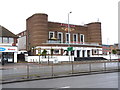
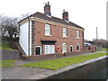
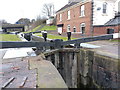
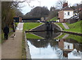
Photos of B42 1DS


Area Information
Living in B42 1DS means inhabiting a small, tightly knit residential cluster in north Birmingham, England. With a population of 1,524, this area is part of the Perry Barr suburb, historically rooted in ancient manors recorded in the Domesday Book. The community is defined by its stability, with 73% of residents owning their homes and a median age of 47, reflecting a mature demographic of adults aged 30–64. Daily life here is shaped by proximity to key amenities, including schools, retail outlets, and transport links. The area’s history includes landmarks like the Birmingham Crematorium and the former Perry Barr Stadium, now demolished, which once hosted greyhound racing and speedway events. While the postcode covers a compact footprint, its strategic location near major roads and public transport networks ensures connectivity to Birmingham’s broader urban fabric. Residents benefit from a blend of suburban tranquillity and access to city resources, making it a practical choice for those seeking a balanced lifestyle.
- Area Type
- Postcode
- Area Size
- Not available
- Population
- 1524
- Population Density
- 2955 people/km²
The property market in B42 1DS is characterised by high home ownership (73%) and a focus on houses rather than flats or apartments. This suggests a suburban, family-oriented area where long-term residency is common. The dominance of houses implies a lower density of housing stock compared to urban centres, which may appeal to buyers seeking more space or garden areas. Given the small size of the postcode, the immediate surroundings likely offer similar housing typologies, creating a consistent market for buyers. The high home ownership rate also indicates limited rental demand, which could mean fewer short-term lettings and a more stable property value trajectory. For prospective buyers, this environment may offer security in a market where properties are less likely to be sold quickly, though the limited scale of the area means opportunities are confined to a small geographic footprint.
House Prices in B42 1DS
No properties found in this postcode.
Energy Efficiency in B42 1DS
Residents of B42 1DS enjoy a range of nearby amenities, from retail outlets to transport hubs. The area is served by five retail venues, including Co-op Walsall, Lidl Birmingham, and Tesco Great, ensuring everyday shopping needs are met without long journeys. Public transport options, such as Hamstead Railway Station and the metro stops at Soho Benson Road, provide easy access to Birmingham’s cultural and commercial centres. While the data does not specify parks or leisure facilities, the proximity to Perry Barr’s historical sites, like the Birmingham Crematorium, adds a layer of local interest. The convenience of shops, combined with reliable transport links, supports a practical lifestyle where daily errands and commutes are efficiently managed. The area’s small size means amenities are closely clustered, enhancing accessibility for all residents.
Amenities
Schools
Residents of B42 1DS have access to Dorrington Primary School, a primary institution serving local children, and Dorrington Academy, an outstanding-rated academy offering secondary education. The presence of both a primary school and a high-performing academy provides families with a comprehensive educational pathway. Dorrington Academy’s Ofsted rating of ‘outstanding’ highlights its quality of teaching and facilities, which is particularly valuable for parents prioritising academic standards. The proximity of these schools to the area ensures minimal travel time for students, supporting a family-friendly environment. The mix of school types also caters to different stages of education, reducing the need for long commutes to other districts. For buyers considering the area, the availability of well-regarded schools is a key factor in assessing its appeal for households with children.
| Rank | School | Type | Entry gender | Ages |
|---|
Explore more schools in this area
Go to Schools tabDemographics
The community in B42 1DS is predominantly composed of adults aged 30–64, with a median age of 47. This suggests a mature, established population, likely with long-term ties to the area. Home ownership is high at 73%, indicating a stable housing market and a focus on long-term residency rather than transient rental occupation. The accommodation type is primarily houses, which aligns with the area’s suburban character. The predominant ethnic group is Asian, reflecting a culturally diverse yet cohesive community. The absence of specific deprivation data means the quality of life cannot be directly assessed, but the high home ownership and age profile suggest a relatively affluent and settled population. This demographic mix supports a range of local services, from schools to retail, tailored to the needs of families and older residents.
Household Size
Accommodation Type
Tenure
Ethnic Group
Religion
Household Composition
Age
Household Deprivation
NS-SEC
Explore more demographic insights in this area
Go to Demographics tabPlanning
Planning Constraints
- Flood RiskPremium
- Ramsar Wetland SitesPremium
- Area of Outstanding Natural BeautyPremium
- Protected Nature ReservePremium
- Protected WoodlandPremium