Area Overview for B42 1DP
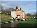
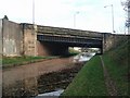
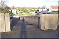
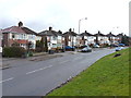
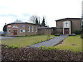
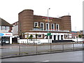
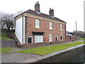
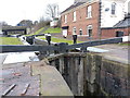
Photos of B42 1DP


Area Information
Living in B42 1DP, a small residential postcode area in north Birmingham, offers a quiet suburban lifestyle within the city’s reach. With a population of 1,524, this area is compact yet well-served by essential services. Its historical roots trace back to the Domesday Book, where it was recorded as two manors, Pirio and Barre. Today, it forms part of the Perry Barr ward, a suburb with a blend of residential housing and local amenities. The area is characterised by its proximity to Birmingham’s urban core, offering easy access to the city’s cultural and economic hubs while maintaining a distinct sense of community. Residents benefit from nearby schools, including the outstanding Dorrington Academy, and a range of transport options. The low crime risk and absence of environmental constraints like flood zones or protected landscapes make it an attractive option for families seeking stability. Despite its small size, B42 1DP combines historical charm with modern convenience, making it a practical choice for those prioritising safety, accessibility, and a balanced lifestyle.
- Area Type
- Postcode
- Area Size
- Not available
- Population
- 1524
- Population Density
- 2955 people/km²
The property market in B42 1DP is dominated by owner-occupied homes, with 73% of properties owned by residents. The accommodation type is predominantly houses, which is typical for suburban areas and may indicate a focus on family homes. This contrasts with rental-heavy zones, suggesting a stable, long-term population. The small size of the postcode area means the housing stock is limited, and buyers may need to consider nearby suburbs for more options. The high home ownership rate also implies strong local demand, potentially supporting property values. For buyers, the mix of houses and the area’s safety profile make it appealing, though the limited size of B42 1DP itself may require looking beyond immediate surroundings for larger selections.
House Prices in B42 1DP
Showing 1 properties
| Address | Type | Beds | Baths | Last Sale Price | Last Sale Date | |
|---|---|---|---|---|---|---|
| Escadean Ltd, Baltimore Road, Birmingham, B42 1DP | Industrial | - | - | - | - |
Energy Efficiency in B42 1DP
The lifestyle in B42 1DP is supported by a range of amenities within practical reach. Retail options include Lidl Birmingham, Co-op Walsall, and M&S Perry, offering everyday shopping needs. Transport links are robust, with rail stations like Hamstead and Perry Barr providing access to Birmingham’s wider network, while metro lines such as Winson Green Outer Circle and Soho Benson Road enhance local mobility. The area’s historical and cultural landmarks, such as Birmingham Crematorium and the former Odeon cinema, add character. While parks and green spaces are not explicitly mentioned, the absence of environmental constraints like AONB or protected woodlands suggests open spaces may be available nearby. The blend of retail, transport, and historical sites contributes to a balanced lifestyle, combining convenience with suburban tranquillity.
Amenities
Schools
Residents of B42 1DP have access to two notable schools: Dorrington Primary School, which serves younger children, and Dorrington Academy, an academy with an outstanding Ofsted rating. The presence of both primary and secondary education options within the area provides convenience for families, reducing the need for long commutes. Dorrington Academy’s high rating reflects strong academic performance and educational standards, which is a significant draw for parents. The combination of a primary school and a top-rated academy ensures a seamless transition through the education system. These institutions likely contribute to the area’s appeal, offering a reliable foundation for children’s learning. The proximity of schools also supports a community-oriented lifestyle, with parents and students frequently interacting in local spaces.
| Rank | School | Type | Entry gender | Ages |
|---|
Explore more schools in this area
Go to Schools tabDemographics
The community in B42 1DP is predominantly composed of adults aged 30–64, with a median age of 47. This suggests a mature, established population, likely with strong ties to the area. Home ownership is high at 73%, indicating a stable residential base with long-term residents. The accommodation type is primarily houses, which aligns with the area’s suburban character and may appeal to families. The predominant ethnic group is Asian, reflecting the broader demographic trends in the West Midlands. This diversity contributes to a culturally rich environment. The absence of specific deprivation data means the area’s quality of life is inferred from its low crime risk and access to amenities. The combination of home ownership and a middle-aged demographic suggests a community focused on long-term living rather than transient rental markets.
Household Size
Accommodation Type
Tenure
Ethnic Group
Religion
Household Composition
Age
Household Deprivation
NS-SEC
Explore more demographic insights in this area
Go to Demographics tabPlanning
Planning Constraints
- Flood RiskPremium
- Ramsar Wetland SitesPremium
- Area of Outstanding Natural BeautyPremium
- Protected Nature ReservePremium
- Protected WoodlandPremium