Area Overview for B42 1DN
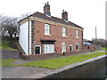
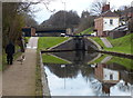
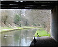
Photos of B42 1DN


Area Information
Living in B42 1DN means inhabiting a compact residential cluster in north Birmingham, part of the historically significant Perry Barr suburb. With a population of 1,524, this area blends suburban tranquillity with proximity to Birmingham’s urban energy. Perry Barr’s name traces back to Old English and Celtic roots, reflecting its long-standing presence in the region. The area is characterised by its small-scale residential layout, offering a sense of community without the density of city centres. Residents benefit from proximity to key amenities, including schools, rail links, and retail hubs. The area’s compact nature means daily life is walkable, with local shops and transport options within practical reach. Historically, Perry Barr has been a hub for cultural and civic activity, from the establishment of the Perry Barr Institute in the 19th century to the opening of Birmingham Crematorium in 1903. Today, it remains a place where heritage and modern living coexist, with a focus on family-oriented living and accessible infrastructure.
- Area Type
- Postcode
- Area Size
- Not available
- Population
- 1524
- Population Density
- 2955 people/km²
The property market in B42 1DN is dominated by owner-occupied homes, with 73% of properties owned by residents rather than rented. The accommodation type is primarily houses, which is typical of suburban areas and suggests a focus on family-friendly living. This contrasts with urban centres where flats and apartments are more common. The high home ownership rate indicates a stable market, with properties likely to hold value over time. For buyers, this means the area is less likely to be a rental hotspot, offering instead a chance to invest in private residences. The small size of the postcode area means properties are closely grouped, potentially limiting the range of options but ensuring proximity to local amenities. Prospective buyers should consider the suburban layout, which prioritises space and privacy over high-density living.
House Prices in B42 1DN
No properties found in this postcode.
Energy Efficiency in B42 1DN
The lifestyle in B42 1DN is shaped by its proximity to a range of amenities. Retail options include Lidl Birmingham, Co-op Walsall, and M&S Perry, providing access to everyday shopping needs. The area’s rail and metro stations connect residents to broader leisure and employment opportunities. While specific parks or recreational spaces are not detailed in the data, the presence of nearby schools and community hubs suggests a focus on family-oriented living. The compact layout ensures that essential services are within walking or short driving distance, reducing the need for long commutes. This convenience fosters a sense of self-sufficiency, with residents able to access shops, transport, and community facilities without leaving the immediate area. The mix of retail and transport options supports a practical, accessible lifestyle.
Amenities
Schools
Residents of B42 1DN have access to two key educational institutions: Dorrington Primary School, a primary school serving younger children, and Dorrington Academy, an outstanding-rated academy for secondary education. The presence of both a primary school and a high-performing academy within the area provides families with a seamless educational pathway. Dorrington Academy’s Ofsted rating of outstanding reflects the quality of teaching and resources available, which is a strong draw for families prioritising academic standards. The combination of these schools suggests a well-supported educational environment, reducing the need for long commutes. For parents, this mix of school types ensures children can access both early years education and advanced learning opportunities locally, enhancing the area’s appeal for families.
| Rank | School | Type | Entry gender | Ages |
|---|
Explore more schools in this area
Go to Schools tabDemographics
The community in B42 1DN is predominantly composed of adults aged 30–64, with a median age of 47. This suggests a mature, stable population, likely with established careers and family structures. Home ownership is high, at 73%, indicating a strong presence of long-term residents. The accommodation type is primarily houses, which aligns with the suburban character of the area. The predominant ethnic group is Asian, reflecting the cultural diversity of the region. This demographic profile suggests a community with a focus on family life and local continuity. The absence of specific deprivation data means quality of life can be inferred from the area’s amenities and safety metrics. With low crime rates and minimal environmental constraints, the area appears to support a balanced lifestyle for its residents.
Household Size
Accommodation Type
Tenure
Ethnic Group
Religion
Household Composition
Age
Household Deprivation
NS-SEC
Explore more demographic insights in this area
Go to Demographics tabPlanning
Planning Constraints
- Flood RiskPremium
- Ramsar Wetland SitesPremium
- Area of Outstanding Natural BeautyPremium
- Protected Nature ReservePremium
- Protected WoodlandPremium