Area Overview for B42 1DH
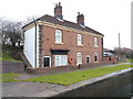
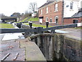
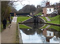
Photos of B42 1DH


Area Information
Living in B42 1DH means inhabiting a small, tightly knit residential cluster in north Birmingham, where history and modernity coexist. With a population of 1,524, this area is part of Perry Barr, a suburb with roots in ancient manors and a legacy of cultural and industrial milestones. The median age of 47 suggests a stable community, with many residents in their prime working years. The area’s compact size fosters a sense of familiarity, though its proximity to Birmingham’s urban sprawl ensures access to city amenities. Historically, Perry Barr was a civil parish before being incorporated into Birmingham, and its streets still reflect this heritage. Today, the area is defined by its low crime rates, excellent broadband connectivity, and a mix of retail and transport options. For those seeking a balance between suburban tranquillity and urban convenience, B42 1DH offers a distinct character shaped by its demographic profile and historical context.
- Area Type
- Postcode
- Area Size
- Not available
- Population
- 1524
- Population Density
- 2955 people/km²
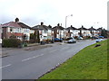
The property market in B42 1DH is dominated by owner-occupied homes, with 73% of residents owning their properties. This high rate of home ownership suggests a stable and established community, where many residents have lived for extended periods. The accommodation type is primarily houses, which are more common than flats or apartments in this area. This housing stock appeals to families and individuals seeking space and privacy, though the small size of the postcode area means the available properties are limited. For buyers, this implies a competitive market with fewer options, potentially driving up prices. The lack of rental properties indicates that the area is less reliant on transient populations, reinforcing its character as a place of long-term residency. Those considering homes in B42 1DH should expect a focus on single-family homes, with limited scope for new developments given the area’s compact size.
House Prices in B42 1DH
No properties found in this postcode.
Energy Efficiency in B42 1DH
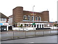
The lifestyle in B42 1DH is enriched by a variety of nearby amenities, from retail outlets to transport hubs. Within practical reach are five retail venues, including Lidl Birmingham, Co-op Walsall, and Tesco Great, offering everyday shopping needs. These stores support a convenient, self-contained lifestyle, reducing the need for long trips to larger retail centres. The area’s transport network further enhances accessibility, with multiple rail and metro stations providing swift connections to Birmingham’s urban core and beyond. While parks and green spaces are not explicitly mentioned in the data, the absence of protected nature reserves or areas of outstanding natural beauty suggests a focus on urban living. Nonetheless, the presence of historical sites like Birmingham Crematorium and the former Odeon cinema adds cultural depth to daily life. Residents benefit from a blend of practical amenities and historical interest, creating a balanced environment for both work and leisure.
Amenities
Schools
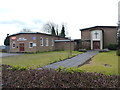
Residents of B42 1DH have access to a range of educational institutions, including Dorrington Primary School, a primary school that serves younger children, and Dorrington Academy, an academy with an outstanding Ofsted rating. This combination of school types ensures families can find both foundational and secondary education within the area. Dorrington Academy’s high rating reflects its commitment to academic excellence and student welfare, making it a strong draw for families prioritising quality education. The presence of two schools within close proximity reduces the need for long commutes, supporting a lifestyle focused on local convenience. For parents, this mix of educational options provides flexibility, whether they are seeking a primary school for young children or a high-performing secondary institution. The schools’ proximity to homes in B42 1DH also aligns with the area’s emphasis on family-friendly living.
| Rank | School | Type | Entry gender | Ages |
|---|
Explore more schools in this area
Go to Schools tabDemographics
The community in B42 1DH is predominantly composed of adults aged 30–64, with a median age of 47. This suggests a population largely in their prime working years, likely supporting a stable local economy. Home ownership is high at 73%, indicating a strong presence of long-term residents and a focus on property as an investment. The area is characterised by houses rather than flats, reflecting a preference for family-oriented living. The predominant ethnic group is Asian, which shapes the cultural fabric of the neighbourhood. While specific deprivation data is not provided, the high home ownership rate and low crime score of 83 suggest a relatively affluent and secure environment. The absence of significant planning constraints, such as protected woodlands or areas of outstanding natural beauty, means development is not hindered by environmental restrictions. This demographic profile points to a community that values stability, family life, and proximity to essential services.
Household Size
Accommodation Type
Tenure
Ethnic Group
Religion
Household Composition
Age
Household Deprivation
NS-SEC
Explore more demographic insights in this area
Go to Demographics tabPlanning
Planning Constraints
- Flood RiskPremium
- Ramsar Wetland SitesPremium
- Area of Outstanding Natural BeautyPremium
- Protected Nature ReservePremium
- Protected WoodlandPremium