Area Overview for B42 1BS
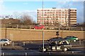
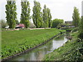
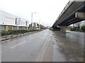
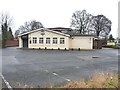
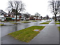
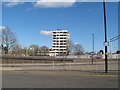
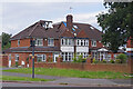
Photos of B42 1BS


Area Information
Living in B42 1BS means residing in a compact, residential postcode cluster within north Birmingham, England. With a population of 2072, this area is small enough to foster a tight-knit community yet positioned within a larger urban context. Historically, the name derives from Old English and Celtic roots—“Perry” from pear trees and “Barr” from a hilltop. Today, it is part of the West Midlands county and lies within the administrative boundaries of Birmingham. The area’s character blends suburban tranquillity with proximity to city amenities, though its small size means it is more of a satellite cluster than a standalone town. Residents benefit from nearby transport links, including multiple railway stations and metro stops, which connect to Birmingham’s broader network. While the area has a modest population, its history includes notable landmarks such as the Birmingham Crematorium and the former Odeon cinema, now repurposed as a conference venue. The demographic profile suggests a mature, family-oriented population, with a median age of 47 and a high proportion of owner-occupied homes. This makes B42 1BS a place where stability and community are central to daily life.
- Area Type
- Postcode
- Area Size
- Not available
- Population
- 2072
- Population Density
- 2878 people/km²
The property market in B42 1BS is dominated by owner-occupied homes, with 66% of residents living in houses rather than flats. This indicates a focus on family-friendly housing stock, likely with larger properties suited to long-term residency. The absence of rental data means it is unclear whether the area is primarily a buyer’s market or has a significant rental component, but the high home ownership rate suggests a preference for private ownership. Given the small postcode area, the housing stock is likely concentrated within a limited geographical footprint, which could mean competition for available properties. The predominance of houses over flats also implies a lower density of development, potentially offering more private outdoor space. For buyers, this means a market that prioritises stability and permanence, though the small size of the area may limit the variety of properties available. Proximity to transport links and amenities adds to its appeal for those seeking a suburban lifestyle without full city isolation.
House Prices in B42 1BS
No properties found in this postcode.
Energy Efficiency in B42 1BS
Residents of B42 1BS have access to a range of nearby amenities that support daily life. Retail options include Asda Perry, M&S Perry, and Iceland Perry, offering essential shopping and leisure purchases. The area’s transport links—such as Perry Barr Railway Station and Hamstead Railway Station—provide easy access to Birmingham’s broader network, while metro stops like Winson Green Outer Circle facilitate local travel. For leisure, the historic Birmingham Crematorium and the former Odeon cinema (now a conference venue) add cultural and historical interest. Though the data does not list parks or recreational spaces explicitly, the proximity to Handsworth and other nearby areas likely offers green spaces and community facilities. The presence of multiple retail and transport hubs suggests a convenient lifestyle, balancing suburban comfort with urban accessibility. The area’s mix of retail, transport, and historical sites creates a practical environment for both daily needs and occasional exploration.
Amenities
Schools
| Rank | School | Type | Entry gender | Ages |
|---|
Explore more schools in this area
Go to Schools tabDemographics
The community in B42 1BS is predominantly composed of adults aged 30–64, with a median age of 47. This suggests a mature population, likely with established careers and families. Home ownership is strong, with 66% of residents owning their homes—a figure that indicates a stable housing market and long-term residency. The area is characterised by houses rather than flats, reflecting a preference for single-family dwellings. The predominant ethnic group is Asian_total, which shapes the cultural landscape and community dynamics. While specific deprivation data is not provided, the high home ownership rate and moderate population size suggest a relatively self-sufficient community. The absence of detailed diversity metrics beyond the predominant ethnic group means the full range of cultural influences remains less defined in the data. However, the presence of multiple retail outlets and transport links implies accessibility for a variety of needs. The age profile and housing type suggest a balance between generational stability and the practicalities of family living.
Household Size
Accommodation Type
Tenure
Ethnic Group
Religion
Household Composition
Age
Household Deprivation
NS-SEC
Explore more demographic insights in this area
Go to Demographics tabPlanning
Planning Constraints
- Flood RiskPremium
- Ramsar Wetland SitesPremium
- Area of Outstanding Natural BeautyPremium
- Protected Nature ReservePremium
- Protected WoodlandPremium