Area Overview for B42 1BL
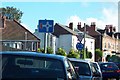
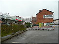
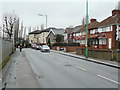
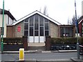
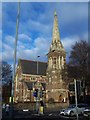
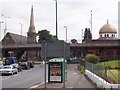
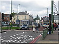
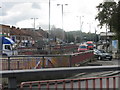
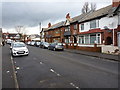
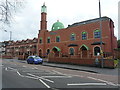
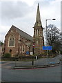
Photos of B42 1BL

Area Information
Living in B42 1BL means inhabiting a small, tightly knit residential cluster in north Birmingham, where history and modernity intersect. The area, known as Perry Barr, has a population of 2,072, reflecting its compact nature. Its name derives from ancient manors recorded in the Domesday Book, with "Perry" meaning "pear tree" and "Barr" signifying "hill top." Despite its modest size, the area offers a blend of suburban tranquility and urban accessibility. Residents benefit from proximity to rail networks, including Perry Barr Railway Station and nearby metro stops, which link to Birmingham’s broader transport system. The community is characterised by a median age of 47, with a majority of residents aged 30–64, suggesting a stable, middle-aged population. The area’s history includes notable landmarks like the Birmingham Crematorium (opened 1903) and the former Odeon cinema, now a conference venue. While the population is relatively small, the area’s integration into Birmingham’s infrastructure ensures connectivity to retail, leisure, and employment hubs. For buyers, B42 1BL presents a niche opportunity in a historically rich yet practical location.
- Area Type
- Postcode
- Area Size
- Not available
- Population
- 2072
- Population Density
- 2878 people/km²
The property market in B42 1BL is defined by a high rate of home ownership (66%) and a predominance of houses over flats or apartments. This suggests a community where residential properties are largely owner-occupied, with a focus on family homes and traditional housing stock. The area’s small size means the housing stock is limited, which could make it a competitive market for buyers seeking properties in a specific location. The absence of rental data means it is unclear whether the area also serves as a rental hub, but the high home ownership rate implies a strong demand for long-term residency. For buyers, the compact nature of B42 1BL means properties are likely to be in close proximity to amenities such as rail stations and retail outlets, though the limited scale of the area may restrict options for larger or more specialised properties.
House Prices in B42 1BL
No properties found in this postcode.
Energy Efficiency in B42 1BL
Residents of B42 1BL have access to a range of nearby amenities, including five retail outlets such as Iceland Perry, Asda Perry, and M&S Perry, which cater to daily shopping needs. The area’s rail network, with stations like Perry Barr Railway Station and Hamstead Railway Station, ensures easy travel to Birmingham’s cultural and commercial centres. While the data does not mention parks or recreational spaces, the historical presence of landmarks like the Birmingham Crematorium and the former Perry Barr Stadium (now demolished) suggests a legacy of community activity. The area’s proximity to the Odeon cinema, now a conference venue, and the Birchfield Community Library (before its 2007 demolition) indicates a tradition of cultural engagement. Though the immediate surroundings lack detailed information on dining or leisure options, the presence of multiple retail and transport hubs implies a functional, if modest, lifestyle for residents.
Amenities
Schools
| Rank | School | Type | Entry gender | Ages |
|---|
Explore more schools in this area
Go to Schools tabDemographics
The community in B42 1BL is predominantly composed of adults aged 30–64, with a median age of 47. This suggests a mature, established population, likely with strong ties to local institutions and long-term residency. Home ownership is high at 66%, indicating a stable housing market where most residents live in their own homes rather than renting. The area is characterised by houses rather than flats or apartments, reflecting a traditional suburban layout. The predominant ethnic group is the Asian_total category, which shapes the cultural and social fabric of the area. While specific data on deprivation or socioeconomic status is not provided, the high home ownership rate and age profile suggest a community with relatively strong economic stability. However, the absence of detailed diversity metrics beyond the predominant ethnic group means the full extent of cultural variety remains unexplored in the data.
Household Size
Accommodation Type
Tenure
Ethnic Group
Religion
Household Composition
Age
Household Deprivation
NS-SEC
Explore more demographic insights in this area
Go to Demographics tabPlanning
Planning Constraints
- Flood RiskPremium
- Ramsar Wetland SitesPremium
- Area of Outstanding Natural BeautyPremium
- Protected Nature ReservePremium
- Protected WoodlandPremium