Area Overview for B4 6EE
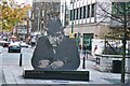
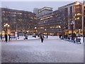
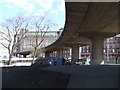
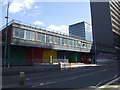
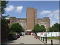
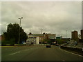
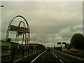
Photos of B4 6EE

Area Information
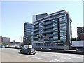
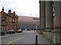
Living in B4 6EE means being part of a small residential cluster in central Birmingham, within the Ladywood Ward. This area is defined by its proximity to key city landmarks, including the Council House and Town Hall, and its historical roots in a medieval woodland that once supplied timber and firewood. With a population of 5,671, it is a compact, urban space where young adults (15–29 years) form the largest demographic group. The area’s character is shaped by its inner-city location, with a mix of modern infrastructure and remnants of post-war redevelopment. Residents benefit from easy access to Birmingham’s cultural and administrative heart, though the area’s history of social challenges persists. The median age of 22 reflects a community skewed toward students and young professionals, many of whom live in flats rather than owner-occupied homes. For those seeking a dynamic, centrally located environment, B4 6EE offers proximity to education, transport, and city amenities, albeit within a densely built, historically complex urban fabric.
- Area Type
- Postcode
- Area Size
- Not available
- Population
- 5671
- Population Density
- 13369 people/km²
The property market in B4 6EE is overwhelmingly rental-focused, with only 3% of residents owning their homes. The accommodation type is predominantly flats, a legacy of post-war redevelopment and the clearance of slums in the 1960s. This housing stock is suited to short-term occupancy, reflecting the area’s demographic skew toward young adults and students. The low home ownership rate indicates limited opportunities for long-term investment, and the small area’s compact size means property options are constrained. For buyers, this suggests a market where owner-occupation is rare, and demand is driven by renters seeking proximity to Birmingham’s city centre. The prevalence of flats also means that larger family homes are uncommon, which may deter those prioritising space or long-term stability. Prospective buyers should consider the area’s limited housing diversity and the potential for high rental yields, though the small footprint of B4 6EE means immediate surroundings may offer similar characteristics.
House Prices in B4 6EE
No properties found in this postcode.
Energy Efficiency in B4 6EE
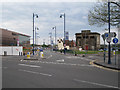
Residents of B4 6EE enjoy a range of amenities within easy reach, from retail to public transport. Nearby shops include Sainsburys Birmingham, Co-op Colmore, and Tesco Birmingham, offering everyday essentials. The metro stations at Bull Street, St Chads, and Corporation Street provide convenient access to shopping, dining, and leisure in central Birmingham. Rail services from Birmingham Snow Hill, Moor Street, and Jewellery Quarter stations connect to broader regional networks, enhancing mobility. While the area lacks large parks or green spaces, its density ensures proximity to cultural and administrative landmarks such as the Council House and Town Hall. The combination of retail, transport, and urban infrastructure supports a lifestyle focused on convenience and connectivity, though those seeking expansive outdoor spaces may need to venture further afield.
Amenities
Schools
Residents of B4 6EE have access to a range of educational institutions, from sixth-form colleges to higher education providers. Matthew Boulton College of Further and Higher Education and Birmingham Metropolitan College both offer sixth-form education, catering to students preparing for university or vocational training. Birmingham City University is also nearby, providing higher education opportunities. For secondary education, Birmingham Ormiston Academy stands out as an academy with a good Ofsted rating, indicating a strong focus on academic performance and student outcomes. The mix of school types reflects the area’s role as a hub for post-16 education, with a particular emphasis on further and higher learning. Families with younger children may need to look beyond B4 6EE for primary schools, but the presence of a rated secondary school and higher education institutions makes it appealing for those prioritising post-secondary pathways.
| Rank | School | Type | Entry gender | Ages |
|---|
Explore more schools in this area
Go to Schools tabDemographics
The population of B4 6EE is predominantly young, with a median age of 22 and the most common age range being 15–29 years. This suggests a community shaped by students, recent graduates, and young professionals. Home ownership is exceptionally low at 3%, indicating that the majority of residents are renters. The accommodation type is primarily flats, reflecting a housing stock designed for urban density rather than family homes. The predominant ethnic group is White, though specific diversity statistics are not provided. The low home ownership rate and high proportion of young adults imply a transient population, often tied to education or employment in central Birmingham. This demographic profile may influence the area’s social dynamics, with a focus on short-term tenancies and shared living arrangements. The absence of detailed deprivation data means quality of life factors such as access to services or housing affordability are not explicitly quantified, but the reliance on rental housing suggests a market-driven, rather than community-oriented, housing model.
Household Size
Accommodation Type
Tenure
Ethnic Group
Religion
Household Composition
Age
Household Deprivation
NS-SEC
Explore more demographic insights in this area
Go to Demographics tabPlanning
Planning Constraints
- Flood RiskPremium
- Ramsar Wetland SitesPremium
- Area of Outstanding Natural BeautyPremium
- Protected Nature ReservePremium
- Protected WoodlandPremium