Area Overview for B38 9SQ
Photos of B38 9SQ
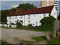
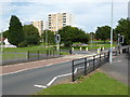
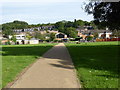
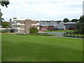
32 photos from this area
Area Information
Key information about the B38 9SQ including its size, population, and administrative classification.
- Area Type
- Postcode
- Area Size
- 1.9 hectares
- Population
- 1411
- Population Density
- 5285 people/km²
House Prices in B38 9SQ
50
Properties
£115,647
Average Sold Price
£25,000
Lowest Price
£185,000
Highest Price
Showing 50 properties
| Address | Type | Beds | Baths | Last Sale Price | Last Sale Date | |
|---|---|---|---|---|---|---|
| 41 Hawkesley End, Birmingham, B38 9SQ | Terraced | 3 | 1 | £178,000 | Mar 2025 | |
| 36 Hawkesley End, Birmingham, B38 9SQ | Terraced | 2 | 1 | £162,000 | Jan 2025 | |
| 11 Hawkesley End, Birmingham, B38 9SQ | Terraced | 2 | 1 | £25,000 | Dec 2024 | |
| 7 Hawkesley End, Birmingham, B38 9SQ | Maisonette | 2 | 1 | £115,000 | Aug 2023 | |
| 18 Hawkesley End, Birmingham, B38 9SQ | Terraced | 3 | 1 | £179,000 | Aug 2023 | |
| 44 Hawkesley End, Birmingham, B38 9SQ | Terraced | 3 | 1 | £180,550 | Jun 2022 | |
| 24 Hawkesley End, Birmingham, B38 9SQ | house | - | - | £185,000 | Jan 2022 | |
| 1 Hawkesley End, Birmingham, B38 9SQ | Flat | - | - | £62,000 | May 2016 | |
| 40 Hawkesley End, Birmingham, B38 9SQ | Terraced | 3 | 1 | £99,000 | Nov 2014 | |
| 55 Hawkesley End, Birmingham, B38 9SQ | house | 2 | - | £105,000 | Jul 2010 |
Page 1 of 5
Energy Efficiency in B38 9SQ
Amenities
Schools
| Rank | School | Type | Entry gender | Ages |
|---|
Explore more schools in this area
Go to Schools tabDemographics
Household Size
One person
most common
Accommodation Type
Houses
most common
Tenure
48
majority
Ethnic Group
White
most common
Religion
N/A
most common
Household Composition
N/A
most common
Age
47
median
Adults (30-64 years)
most common
Household Deprivation
N/A
with no deprivation
NS-SEC
19
in Lower managerial occupations
Explore more demographic insights in this area
Go to Demographics tabPlanning
Planning Constraints
- Flood RiskPremium
- Ramsar Wetland SitesPremium
- Area of Outstanding Natural BeautyPremium
- Protected Nature ReservePremium
- Protected WoodlandPremium