Area Overview for B38 9RZ
Photos of B38 9RZ
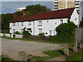
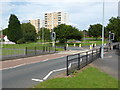
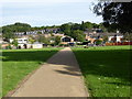
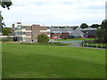
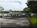
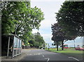
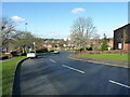
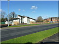
32 photos from this area
Area Information
Key information about the B38 9RZ including its size, population, and administrative classification.
- Area Type
- Postcode
- Area Size
- 1.6 hectares
- Population
- 1424
- Population Density
- 4211 people/km²
House Prices in B38 9RZ
50
Properties
£131,865
Average Sold Price
£51,250
Lowest Price
£216,000
Highest Price
Showing 50 properties
| Address | Type | Beds | Baths | Last Sale Price | Last Sale Date | |
|---|---|---|---|---|---|---|
| 39 Red Hill Grove, Birmingham, B38 9RZ | Semi-detached | 3 | 1 | £216,000 | Sep 2025 | |
| 45 Red Hill Grove, Birmingham, B38 9RZ | house | - | - | £180,000 | Aug 2025 | |
| 5 Red Hill Grove, Birmingham, B38 9RZ | house | - | - | £205,000 | Mar 2025 | |
| 36 Red Hill Grove, Birmingham, B38 9RZ | Terraced | 2 | 1 | £142,000 | Jul 2023 | |
| 21 Red Hill Grove, Birmingham, B38 9RZ | Semi-detached | 3 | 2 | £81,000 | Oct 2022 | |
| 7 Red Hill Grove, Birmingham, B38 9RZ | Retail | 3 | 1 | £192,000 | May 2022 | |
| 3 Red Hill Grove, Birmingham, B38 9RZ | Semi-detached | 3 | 1 | £190,000 | Feb 2022 | |
| 30 Red Hill Grove, Birmingham, B38 9RZ | Maisonette | - | - | £70,000 | Jul 2021 | |
| 16 Red Hill Grove, Birmingham, B38 9RZ | Terraced | 2 | 1 | £120,000 | Mar 2020 | |
| 10 Red Hill Grove, Birmingham, B38 9RZ | Semi-detached | 2 | - | £135,000 | Jul 2019 |
Page 1 of 5
Energy Efficiency in B38 9RZ
Amenities
Schools
| Rank | School | Type | Entry gender | Ages |
|---|
Explore more schools in this area
Go to Schools tabDemographics
Household Size
Family (3-5 people)
most common
Accommodation Type
Houses
most common
Tenure
45
majority
Ethnic Group
White
most common
Religion
N/A
most common
Household Composition
N/A
most common
Age
47
median
Adults (30-64 years)
most common
Household Deprivation
N/A
with no deprivation
NS-SEC
20
in Lower managerial occupations
Explore more demographic insights in this area
Go to Demographics tabPlanning
Planning Constraints
- Flood RiskPremium
- Ramsar Wetland SitesPremium
- Area of Outstanding Natural BeautyPremium
- Protected Nature ReservePremium
- Protected WoodlandPremium