Area Overview for B38 9LR
Photos of B38 9LR


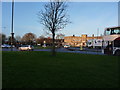
48 photos from this area
Area Information
Key information about the B38 9LR including its size, population, and administrative classification.
- Area Type
- Postcode
- Area Size
- 1.3 hectares
- Population
- 1408
- Population Density
- 7711 people/km²
House Prices in B38 9LR
51
Properties
£187,360
Average Sold Price
£64,000
Lowest Price
£236,000
Highest Price
Showing 51 properties
| Address | Type | Beds | Baths | Last Sale Price | Last Sale Date | |
|---|---|---|---|---|---|---|
| 75 Heathside Drive, Birmingham, B38 9LR | Semi-detached | 2 | 2 | £230,000 | Aug 2023 | |
| 73 Heathside Drive, Birmingham, B38 9LR | Semi-detached | 2 | 2 | £185,000 | Mar 2021 | |
| 77 Heathside Drive, Birmingham, B38 9LR | Semi-detached | 3 | 2 | £236,000 | Aug 2020 | |
| 79 Heathside Drive, Birmingham, B38 9LR | Semi-detached | 3 | 2 | £225,000 | Aug 2020 | |
| 67 Heathside Drive, Birmingham, B38 9LR | Semi-detached | 3 | 1 | £218,000 | Apr 2019 | |
| 53 Heathside Drive, Birmingham, B38 9LR | Semi-detached | 3 | 1 | £208,500 | Jul 2018 | |
| 57 Heathside Drive, Birmingham, B38 9LR | Semi-detached | 3 | 2 | £209,950 | Apr 2018 | |
| 61 Heathside Drive, Birmingham, B38 9LR | house | 3 | 2 | £191,000 | May 2017 | |
| 65 Heathside Drive, Birmingham, B38 9LR | Semi-detached | 3 | 1 | £205,000 | Jun 2016 | |
| 81 Heathside Drive, Birmingham, B38 9LR | Semi-detached | 3 | 1 | £162,000 | Oct 2014 |
Page 1 of 6
Energy Efficiency in B38 9LR
Amenities
Schools
| Rank | School | Type | Entry gender | Ages |
|---|
Explore more schools in this area
Go to Schools tabDemographics
Household Size
Family (3-5 people)
most common
Accommodation Type
Houses
most common
Tenure
36
majority
Ethnic Group
White
most common
Religion
N/A
most common
Household Composition
N/A
most common
Age
22
median
Adults (30-64 years)
most common
Household Deprivation
N/A
with no deprivation
NS-SEC
22
in Lower managerial occupations
Explore more demographic insights in this area
Go to Demographics tabPlanning
Planning Constraints
- Flood RiskPremium
- Ramsar Wetland SitesPremium
- Area of Outstanding Natural BeautyPremium
- Protected Nature ReservePremium
- Protected WoodlandPremium