Area Overview for B38 9AX
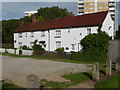
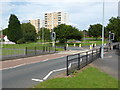
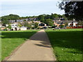
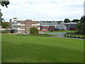
Photos of B38 9AX
Area Information
King's Norton South Ward forms the residential cluster of postcode B38 9AX, covering a small footprint of 1.1 hectares. You live in a neighbourhood with a population of 1,709 people, creating a dense environment that retains the character of a settlement while functioning as part of a larger suburb. This specific locale sits approximately 6.5 miles south-southwest of Birmingham city centre. The area originated as the northernmost settlement of Bromsgrove's berewicks, recorded as 'Nortune' in the Domesday Book. It developed from a royal manor separated from Bromsgrove in 1564 until 1804. This history explains the retained village feel despite urban expansion. Stone Street still holds the historic core, though modern housing estates like Hawkesley now dominate the immediate streetscapes. Life here involves navigating a transition from historic charm to modern suburban density. You gain access to major transport routes including the A441 Redditch Road and the Birmingham and Worcester canal. The area remains close to the historic Saracen's Head pub and St Nicolas Church. While the concentration of residents is high at 156,856 people per square kilometre, the community benefits from substantial green spaces and proximity to the oval architecture of the area. Living in B38 9AX means accepting a tight-knit village atmosphere within a rapidly developing conurbation.
- Area Type
- Postcode
- Area Size
- 1.1 hectares
- Population
- 1709
- Population Density
- 3415 people/km²
B38 9AX operates as a mixed market with 31% home ownership levels. Houses remain the predominant accommodation type across this residential cluster. This balance indicates that while there is an established base of owner-occupiers, a larger portion of the population rents from landlords or through other non-ownership arrangements. The stock consists mainly of properties that date back to the 1950s, 1960s, and 1970s, alongside earlier villas near The Green. Given the small area size of 1.1 hectares, space is at a premium and many streets are fully built out. You are unlikely to find extensive new build developments directly within this specific postcode, as the land is already fully utilized. Buyers looking at homes in B38 9AX often focus on the character of Victorian terraces or the more uniform slab estates found in areas like Hawkesley. The low ownership rate suggests investment opportunities exist for those with capital, but competition from tenants keeps prices competitive. If you prefer living in an area where neighbours own their homes, you may find slower sales cycles as sellers prioritize stability. The housing stock reflects the area's history as part of the post-war expansion of Birmingham into the suburbs. Properties vary from well-maintained period features to practical modern layouts. You must consider that older cottages near the church may require more maintenance than the standardised homes in the later estates.
House Prices in B38 9AX
Showing 33 properties
| Address | Type | Beds | Baths | Last Sale Price | Last Sale Date | |
|---|---|---|---|---|---|---|
| 14 Stockmans Close, Birmingham, B38 9AX | Semi-detached | 3 | 1 | £240,000 | Apr 2024 | |
| 59 Stockmans Close, Birmingham, B38 9AX | Semi-detached | 3 | 3 | £257,000 | Nov 2023 | |
| 71 Stockmans Close, Birmingham, B38 9AX | Semi-detached | 4 | 1 | £237,000 | Jan 2023 | |
| 53 Stockmans Close, Birmingham, B38 9AX | Semi-detached | 3 | 1 | £197,000 | Dec 2021 | |
| 73 Stockmans Close, Birmingham, B38 9AX | Semi-detached | 4 | 2 | £205,000 | Oct 2018 | |
| 69 Stockmans Close, Birmingham, B38 9AX | Terraced | 3 | 2 | £160,000 | Dec 2017 | |
| 57 Stockmans Close, Birmingham, B38 9AX | house | - | - | £159,995 | Jun 2016 | |
| 26 Stockmans Close, Birmingham, B38 9AX | Detached | 1 | 3 | £159,995 | Mar 2016 | |
| 16 Stockmans Close, Birmingham, B38 9AX | house | - | - | £154,000 | Mar 2016 | |
| 55 Stockmans Close, Birmingham, B38 9AX | house | - | - | £159,995 | Feb 2016 |
Energy Efficiency in B38 9AX
Living in B38 9AX places you within striking distance of various retail and transport hubs. Five key retail locations sit within practical reach, including Aldi Tunnel, Spar, and Co-op Kings. These shops handle your essential grocery needs and daily errands. You can complete a weekly shopping run without leaving the immediate neighbourhood. Five rail stations serve the area, including Kings Norton Railway Station, Northfield Railway Station, and Longbridge Railway Station. These termini offer connections to wider networks for commuting to Birmingham or other business centres. Additionally, five key Metro locations lie close by, such as Edgbaston Village, Centenary Square, and the Town Hall. This trio of transport categories ensures you never feel cut off from the wider city. The availability of convenience stores means you can grab fresh produce or tinned goods quickly. You might browse the aisles of the tunnel for budget-friendly options or visit the Spar for parcels. The integration of rail and bus links allows you to bypass traffic jams on the A440. A trip to Centenary Square offers a change of scenery and access to broader city amenities. The proximity to shops and stations creates a self-sufficient bubble where major needs are met locally. You balance the quiet of a residential street with the convenience of nearby amenities. Daily life involves short walks to essential services while retaining a suburban backdrop.
Amenities
Schools
Four primary institutions serve the educational needs of families living near B38 9AX. Hawkesley Church Primary Academy holds a 'good' Ofsted rating and operates as a primary school. Hawkesley CofE and Methodist Infant School and Hawkesley Anglican Methodist Church Junior School both serve as primary institutions. Hawkesley CofE/Methodist Primary School also caters to younger children in this locality. This concentration of primary schools reflects the strong demand for nearby education in a dense cluster. You have access to religious community schools which often foster tight-knit peer groups. The presence of multiple options means transport routes between home and school can remain consistent throughout the year. Families do not usually need to travel far to secure a local place. The mix of Church of England and Methodist foundations indicates a non-sectarian yet faith-oriented educational environment. Proximity allows residents to monitor attendance and participate in school events easily. If you are moving to the area, you will find that these schools are the main provision for infant and junior education. Secondary education options are not available within the immediate hexagon radius of this postcode. Parents in B38 9AX rely on these local feeder systems before transitioning to secondary institutions further afield. The high density ensures these schools receive a steady intake of pupils from the surrounding streets.
| Rank | School | Type | Entry gender | Ages |
|---|
Explore more schools in this area
Go to Schools tabDemographics
The community in B38 9AX skews older than the national average, with a median age of 47 years. Adults between the ages of 30 and 64 years constitute the most common age range within the ward. Only 31% of residents own their homes outright, indicating a market where renting or other tenure types remain prevalent. Houses make up the primary accommodation type in this postcode area. The population is predominantly White, reflecting the area's established settlement patterns. This demographic profile suggests a district where mature families and long-term residents form the backbone of the community. The high population density contributes to a lively street scene but also means services are in high demand. You will find that daily life revolves around central locations like The Green, where historic buildings and modern life intersect. The area does not show signs of significant youth influx or rapid student population turnover. Instead, the social fabric relies on stability and continuity. With fewer than 50% of households owning their property, the housing market operates with a significant rental component. Residents navigate a neighbourhood where community interaction is frequent due to the compact nature of the 1.1-hectare cluster. The age mix fosters a quiet environment in the evenings, suitable for families with older children or retirees seeking a slower pace than city living offers.
Household Size
Accommodation Type
Tenure
Ethnic Group
Religion
Household Composition
Age
Household Deprivation
NS-SEC
Explore more demographic insights in this area
Go to Demographics tabPlanning
Planning Constraints
- Flood RiskPremium
- Ramsar Wetland SitesPremium
- Area of Outstanding Natural BeautyPremium
- Protected Nature ReservePremium
- Protected WoodlandPremium