Area Overview for B38 8TA
Photos of B38 8TA


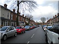

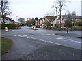
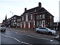
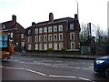

55 photos from this area
Area Information
Key information about the B38 8TA including its size, population, and administrative classification.
- Area Type
- Postcode
- Area Size
- 3.7 hectares
- Population
- 1369
- Population Density
- 1317 people/km²
House Prices in B38 8TA
18
Properties
£348,583
Average Sold Price
£96,000
Lowest Price
£695,000
Highest Price
Showing 18 properties
| Address | Type | Beds | Baths | Last Sale Price | Last Sale Date | |
|---|---|---|---|---|---|---|
| 44 Wychall Lane, Birmingham, B38 8TA | Detached | 6 | 3 | £695,000 | Sep 2025 | |
| 38 Wychall Lane, Birmingham, B38 8TA | Semi-detached | 4 | 2 | £495,000 | Mar 2024 | |
| 40 Wychall Lane, Birmingham, B38 8TA | Detached | 3 | 1 | £592,000 | Nov 2023 | |
| 14 Wychall Lane, Birmingham, B38 8TA | Detached | 3 | 1 | £410,000 | Jan 2023 | |
| 30 Wychall Lane, Birmingham, B38 8TA | Semi-detached | 5 | 1 | £312,000 | Apr 2019 | |
| 34 Wychall Lane, Birmingham, B38 8TA | Detached | 3 | 2 | £307,000 | Jul 2018 | |
| 22 Wychall Lane, Birmingham, B38 8TA | Detached | 4 | - | £368,000 | Aug 2017 | |
| 10 Wychall Lane, Birmingham, B38 8TA | Semi-detached | 4 | 2 | £225,000 | Jul 2012 | |
| 12 Wychall Lane, Birmingham, B38 8TA | Detached | 4 | 2 | £240,000 | Sep 2005 | |
| 36 Wychall Lane, Birmingham, B38 8TA | Semi-detached | - | - | £275,000 | Jun 2004 |
Page 1 of 2
Energy Efficiency in B38 8TA
Amenities
Schools
| Rank | School | Type | Entry gender | Ages |
|---|
Explore more schools in this area
Go to Schools tabDemographics
Household Size
Two person
most common
Accommodation Type
Houses
most common
Tenure
90
majority
Ethnic Group
White
most common
Religion
N/A
most common
Household Composition
N/A
most common
Age
47
median
Adults (30-64 years)
most common
Household Deprivation
N/A
with no deprivation
NS-SEC
49
in Lower managerial occupations
Explore more demographic insights in this area
Go to Demographics tabPlanning
Planning Constraints
- Flood RiskPremium
- Ramsar Wetland SitesPremium
- Area of Outstanding Natural BeautyPremium
- Protected Nature ReservePremium
- Protected WoodlandPremium