Area Overview for B38 8HX
Photos of B38 8HX


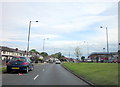


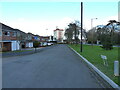
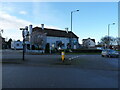


22 photos from this area
Area Information
Key information about the B38 8HX including its size, population, and administrative classification.
- Area Type
- Postcode
- Area Size
- 9268 m²
- Population
- 1648
- Population Density
- 4056 people/km²
House Prices in B38 8HX
21
Properties
£142,100
Average Sold Price
£88,000
Lowest Price
£215,000
Highest Price
Showing 21 properties
| Address | Type | Beds | Baths | Last Sale Price | Last Sale Date | |
|---|---|---|---|---|---|---|
| 432 Rednal Road, Birmingham, B38 8HX | Terraced | 2 | 1 | £210,000 | Apr 2023 | |
| 434 Rednal Road, Birmingham, B38 8HX | Terraced | 4 | 1 | £215,000 | Jul 2022 | |
| 426 Rednal Road, Birmingham, B38 8HX | Flat | 3 | 1 | £90,000 | Aug 2015 | |
| 436 Rednal Road, Birmingham, B38 8HX | house | - | - | £88,000 | May 2012 | |
| 438 Rednal Road, Birmingham, B38 8HX | Terraced | 3 | - | £107,500 | Jan 2012 | |
| 412 Rednal Road, Birmingham, B38 8HX | Maisonette | 3 | 1 | - | - | |
| 416 Rednal Road, Birmingham, B38 8HX | Bungalow | - | - | - | - | |
| 442 Rednal Road, Birmingham, B38 8HX | Semi-detached | - | - | - | - | |
| 430 Rednal Road, Birmingham, B38 8HX | Flat | - | - | - | - | |
| 440 Rednal Road, Birmingham, B38 8HX | house | - | - | - | - |
Page 1 of 3
Energy Efficiency in B38 8HX
Amenities
Schools
| Rank | School | Type | Entry gender | Ages |
|---|
Explore more schools in this area
Go to Schools tabDemographics
Household Size
One person
most common
Accommodation Type
Houses
most common
Tenure
36
majority
Ethnic Group
White
most common
Religion
N/A
most common
Household Composition
N/A
most common
Age
47
median
Adults (30-64 years)
most common
Household Deprivation
N/A
with no deprivation
NS-SEC
18
in Lower managerial occupations
Explore more demographic insights in this area
Go to Demographics tabPlanning
Planning Constraints
- Flood RiskPremium
- Ramsar Wetland SitesPremium
- Area of Outstanding Natural BeautyPremium
- Protected Nature ReservePremium
- Protected WoodlandPremium