Area Overview for B38 8HU
Photos of B38 8HU


Area Information
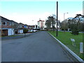
The postcode area B38 8HU represents a specific residential cluster within the wider Longbridge and West Heath ward in south-west Birmingham. This location sits in a unitary authority electoral division with a total population of 21,654, placing it between Kings Norton, Northfield, Longbridge, and Cofton Hackett. The immediate B38 8HU cluster itself serves 1,648 people, forming a subtended community on the traditional heathland that was once part of the historic Kings Norton manorial lands. Originally an open farmland area, this suburb transitioned into a dormitory settlement following post-war housing development to accommodate returning servicemen and bombing victims. The village of West Heath, centred on the medieval Lilley Lane, developed significantly in the 1940s through 1970s, shifting from prefab housing to permanent estates. Today, you live in a residential entity that balances its suburban character with proximity to Birmingham's wider infrastructure, located roughly at 52.3933°N, 1.9889°W. This makes it the most southerly ward in the city while maintaining strong links to the west midlands corridor.
- Area Type
- Postcode
- Area Size
- Not available
- Population
- 1648
- Population Density
- 4056 people/km²
You are looking at a market where houses constitute the primary accommodation type for the B38 8HU postcode. With home ownership recorded at just 36%, a large portion of the local residents rent their properties, indicating a dynamic mix of owners and tenants in this specific residential cluster. This suggests that while some long-term residents have established equity in their homes, the area retains an accessible element for those seeking to move in via the rental sector. The presence of houses rather than flats aligns with the historical post-war estate developments that replaced prefabricated accommodation in the 1960s and 1970s. Buyers considering homes in this area find a stock that is largely detached or semi-detached, typical of the suburban sprawl extending from West Heath village. There are no high-rise blocks or urban flats dominating this specific postcode, making it suitable for households that prefer garden space and a more residential street environment compared to central Birmingham densities.
House Prices in B38 8HU
No properties found in this postcode.
Energy Efficiency in B38 8HU
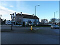
Your daily life in B38 8HU benefits from a practical range of amenities located within practical reach. Retail options are well represented, with five notable venues nearby including Tesco West, Spar, and Morrisons Daily, ensuring you can gather groceries and essentials without a long drive. Transport links connect you to five main train stations, specifically Northfield Railway Station, Longbridge Railway Station, and Kings Norton Railway Station, facilitating easy commutes into Birmingham. Five major metro stops serve the wider area, including Edgbaston Village, Centenary Square, and Town Hall, providing access to city centre culture and business districts. The area includes a small industrial estate in Lightning Way off Alvechurch Road, adding a local commercial element. This combination of retail superstores, multiple railheads, and bus links to Edgbaston creates a convenient lifestyle where you can manage household needs locally while accessing major city attractions minutes away by public transport.
Amenities
Schools
Families living in B38 8HU have access to three primary schools listed within the immediate vicinity as part of your educational options. West Heath Infant School operates as a primary institution serving younger children in the area. West Heath Junior School functions as a separate primary school, feeding into the secondary pipeline alongside the infant provision. West Heath Primary School holds a good Ofsted rating, providing a verified standard of education for residents. This mix of infant, junior, and a single rated primary school means you do not have a dedicated secondary school listed directly within this specific data set for B38 8HU. Instead, the educational provision focuses on early years and primary education, characteristic of a suburb that often sends adolescents to larger comprehensive colleges further away. The presence of schools like Cofton Primary and Turves Green Schools in the broader research context suggests a wider network, but only the three West Heath schools are confirmed for your immediate postcode.
| Rank | School | Type | Entry gender | Ages |
|---|
Explore more schools in this area
Go to Schools tabDemographics
The community in B38 8HU reflects a settled, mid-life population structure with a median age of 47 years. Adults aged between 30 and 64 years form the most common age range within this postcode area. Current statistics indicate that home ownership stands at 36% of households, suggesting a significant balance between owner-occupiers and renters in this specific cluster. The accommodation type is predominantly houses, reinforcing the suburban nature of the settlement rather than high-density urban living. Diversity figures show that the predominant ethnic group is White, with no other ethnicities listed in the current demographic breakdown for this specific area. These figures point to a neighbourhood designed for families or established individuals seeking housing stability. The demographic profile clearly excludes younger families with very young children or an elderly population seeking retirement communities, as the age median and dominance of the 30-64 bracket define the social rhythm of daily life here.
Household Size
Accommodation Type
Tenure
Ethnic Group
Religion
Household Composition
Age
Household Deprivation
NS-SEC
Explore more demographic insights in this area
Go to Demographics tabPlanning
Planning Constraints
- Flood RiskPremium
- Ramsar Wetland SitesPremium
- Area of Outstanding Natural BeautyPremium
- Protected Nature ReservePremium
- Protected WoodlandPremium