Area Overview for B38 8BJ
Photos of B38 8BJ
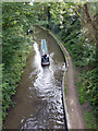
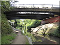
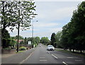
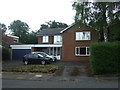
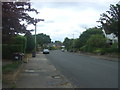
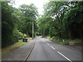
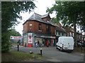
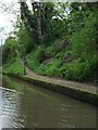
49 photos from this area
Area Information
Key information about the B38 8BJ including its size, population, and administrative classification.
- Area Type
- Postcode
- Area Size
- 2.1 hectares
- Population
- 1369
- Population Density
- 1317 people/km²
House Prices in B38 8BJ
17
Properties
£606,204
Average Sold Price
£249,500
Lowest Price
£1,060,000
Highest Price
Showing 17 properties
| Address | Type | Beds | Baths | Last Sale Price | Last Sale Date | |
|---|---|---|---|---|---|---|
| 39 Beaks Hill Road, Birmingham, B38 8BJ | house | 4 | 2 | £555,000 | Jul 2025 | |
| 17 Beaks Hill Road, Birmingham, B38 8BJ | Detached | 5 | 4 | £1,060,000 | Sep 2021 | |
| 43 Beaks Hill Road, Birmingham, B38 8BJ | Detached | 4 | - | £660,000 | Jan 2021 | |
| 41 Beaks Hill Road, Birmingham, B38 8BJ | Bungalow | 3 | 1 | £660,000 | Nov 2020 | |
| 15 Beaks Hill Road, Birmingham, B38 8BJ | house | - | - | £550,000 | Oct 2020 | |
| 17A Beaks Hill Road, Birmingham, B38 8BJ | Detached | 3 | 2 | £760,000 | Jan 2020 | |
| 23 Beaks Hill Road, Birmingham, B38 8BJ | Detached | 5 | 3 | £735,000 | Sep 2019 | |
| 25 Beaks Hill Road, Birmingham, B38 8BJ | Detached | 4 | 4 | £615,000 | May 2019 | |
| 9 Beaks Hill Road, Birmingham, B38 8BJ | Detached | 4 | 3 | £530,000 | Oct 2016 | |
| 19 Beaks Hill Road, Birmingham, B38 8BJ | house | - | - | £500,000 | Jul 2004 |
Page 1 of 2
Energy Efficiency in B38 8BJ
Amenities
Schools
| Rank | School | Type | Entry gender | Ages |
|---|
Explore more schools in this area
Go to Schools tabDemographics
Household Size
Two person
most common
Accommodation Type
Houses
most common
Tenure
90
majority
Ethnic Group
White
most common
Religion
N/A
most common
Household Composition
N/A
most common
Age
47
median
Adults (30-64 years)
most common
Household Deprivation
N/A
with no deprivation
NS-SEC
49
in Lower managerial occupations
Explore more demographic insights in this area
Go to Demographics tabPlanning
Planning Constraints
- Flood RiskPremium
- Ramsar Wetland SitesPremium
- Area of Outstanding Natural BeautyPremium
- Protected Nature ReservePremium
- Protected WoodlandPremium