Area Overview for B38 8AZ
Photos of B38 8AZ
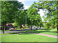
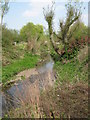
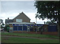
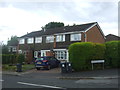
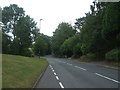
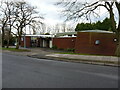

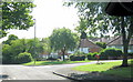
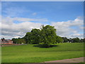
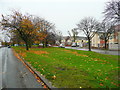
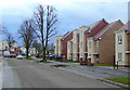
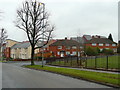
Area Information
B38 8AZ is a small residential postcode area in England, part of the broader King’s Norton North Ward within Birmingham City Council. With a population of just over 1,000, it reflects a compact, closely knit community. The area’s historical roots trace back to Early English settlements, evolving from a Royalist stronghold during the Civil War to a suburban enclave within Birmingham’s southern reaches. Today, it balances historic charm with modern practicality, positioned near the Worcestershire border. Residents here benefit from proximity to transport networks, including rail links to Kings Norton, Northfield, and Longbridge stations, as well as metro stops at Edgbaston Village and Centenary Square. Daily life is shaped by its modest size, with local shops like Aldi Tunnel, Spar, and Tesco West within easy reach. The area’s appeal lies in its low flood risk, absence of environmental constraints, and a population predominantly aged 30–64, suggesting a stable, mature community focused on established living.
- Area Type
- Postcode
- Area Size
- Not available
- Population
- 1023
- Population Density
- 3330 people/km²
B38 8AZ is predominantly an owner-occupied area, with 87% of properties owned by residents rather than rented. The accommodation type is houses, which is uncommon in many urban postcode areas, suggesting a focus on single-family homes. This makes the area distinct from high-density rental markets, positioning it as a place where residents are likely to have long-term plans for their properties. The small population and limited number of homes imply a tight local market, with limited scope for new developments. For buyers, this means competition may be fierce for available properties, but it also signals a stable, low-turnover market. The lack of flats or apartments further reinforces the area’s character as a suburban, family-oriented postcode with a strong emphasis on private ownership.
House Prices in B38 8AZ
No properties found in this postcode.
Energy Efficiency in B38 8AZ
Residents of B38 8AZ have access to a range of local amenities within practical reach. Retail options include Aldi Tunnel, Spar, and Tesco West, ensuring daily shopping needs are met. The area’s rail and metro connections—such as Kings Norton Station and Edgbaston Village—provide easy access to Birmingham’s cultural and commercial districts. While specific parks or leisure facilities are not detailed in the data, the absence of environmental constraints like protected woodlands or AONB designations suggests open spaces may be available nearby. The proximity to historical sites and the canal hints at a blend of practicality and heritage, offering both convenience and a touch of local character. This mix of retail, transport, and historical context shapes a lifestyle that balances suburban comfort with urban accessibility.
Amenities
Schools
| Rank | School | Type | Entry gender | Ages |
|---|
Explore more schools in this area
Go to Schools tabDemographics
The population of B38 8AZ is 1,023, with a median age of 47, indicating a mature demographic skewed towards adults aged 30–64. Home ownership is high, at 87%, suggesting a strong presence of long-term residents rather than transient renters. The area is predominantly White, with no specific data provided on other ethnic groups. The accommodation type is primarily houses, which aligns with the higher home ownership rate and implies a mix of family homes and detached properties. This profile suggests a community focused on stability, with residents likely prioritising established living over rental flexibility. The absence of detailed deprivation data means no direct commentary on economic hardship, but the high home ownership and median age suggest a relatively secure financial base for most households.
Household Size
Accommodation Type
Tenure
Ethnic Group
Religion
Household Composition
Age
Household Deprivation
NS-SEC
Explore more demographic insights in this area
Go to Demographics tabPlanning
Planning Constraints
- Flood RiskPremium
- Ramsar Wetland SitesPremium
- Area of Outstanding Natural BeautyPremium
- Protected Nature ReservePremium
- Protected WoodlandPremium