Area Overview for B37 9DX
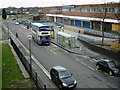
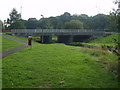
Photos of B37 9DX
Area Information
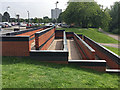
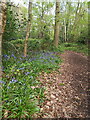
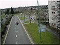
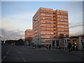
B37 9DX is a small residential cluster in the Metropolitan Borough of Solihull, part of the Chelmsley Wood civil parish. With a population of 1,881, it is a compact area shaped by post-war development. Constructed in the late 1960s and early 1970s, the area was designed as an overspill estate for Birmingham residents, built on ancient woodland once part of the Forest of Arden. Today, it features a mix of housing types, including multi-storey blocks, and follows the Radburn planning model with pedestrian pathways and open green spaces. The town centre includes a 1970s shopping centre, a library, and local amenities, creating a self-contained community. While the area has faced challenges, such as past deprivation linked to unemployment, it now benefits from a town council and ongoing renovations. Living here offers proximity to rail networks, Birmingham International Airport, and a range of retail options, making it a practical choice for those seeking a balance between suburban living and urban connectivity.
- Area Type
- Postcode
- Area Size
- Not available
- Population
- 1881
- Population Density
- 4000 people/km²
The property market in B37 9DX is characterised by a 36% home ownership rate, suggesting a rental-dominated market. The area’s housing stock includes both traditional houses and multi-storey blocks built during the 1960s and 1970s. This mix of accommodation types reflects its origins as a council estate designed to rehouse Birmingham residents. For buyers, the limited number of owner-occupied properties may make it challenging to find a home for purchase, though the presence of houses could appeal to those seeking larger properties. The small area’s proximity to rail networks and retail hubs may enhance its appeal, but the low home ownership rate indicates that the market is more suited to renters than buyers.
House Prices in B37 9DX
No properties found in this postcode.
Energy Efficiency in B37 9DX
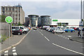
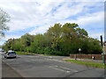
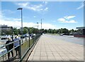
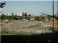
The lifestyle in B37 9DX is shaped by its mix of retail, transport, and community amenities. Nearby shops include Asda Chelmsley, Iceland Chelmsley, and Heron Chelmsley, providing essential retail options. The area’s town centre features a 1970s shopping centre, a library, two pubs, and a hall, fostering a sense of local identity. The Radburn-inspired layout with open green spaces and pedestrian pathways encourages outdoor activity. Rail stations and Birmingham International Airport ensure connectivity, while the proximity to Solihull and Birmingham offers access to broader cultural and leisure opportunities. This blend of practicality and community-focused design supports a convenient, self-contained lifestyle.
Amenities
Schools
The nearest school to B37 9DX is The City Technology College, a secondary school. No other schools are listed in the data, meaning families relying on local education may need to look beyond the immediate area. The absence of primary schools or additional secondary options could impact convenience for families, though the proximity to larger towns like Solihull or Birmingham may provide alternative schooling choices. The single listed school suggests a limited educational ecosystem, requiring careful consideration for those prioritising local schools.
| Rank | School | Type | Entry gender | Ages |
|---|
Explore more schools in this area
Go to Schools tabDemographics
The median age in B37 9DX is 47, with the majority of residents falling within the 30-64 age range. Home ownership is low at 36%, indicating that most households are renters. The accommodation type is predominantly houses, though the area’s original design included 39 multi-storey blocks of flats. The predominant ethnic group is White, reflecting the area’s post-war origins. This demographic profile suggests a mature, stable community with a focus on family living, though the lower home ownership rate may indicate a reliance on rental housing. The absence of specific data on deprivation levels means that quality of life factors such as access to services and employment opportunities are inferred from the available amenities and infrastructure.
Household Size
Accommodation Type
Tenure
Ethnic Group
Religion
Household Composition
Age
Household Deprivation
NS-SEC
Explore more demographic insights in this area
Go to Demographics tabPlanning
Planning Constraints
- Flood RiskPremium
- Ramsar Wetland SitesPremium
- Area of Outstanding Natural BeautyPremium
- Protected Nature ReservePremium
- Protected WoodlandPremium