Area Overview for B37 9DW
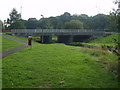
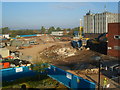
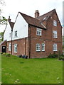
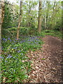
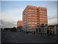
Photos of B37 9DW


Area Information
Living in B37 9DW, part of Chelmsley Wood in Solihull, offers a blend of post-war urban planning and modern convenience. This small residential cluster, built in the late 1960s and early 1970s by Birmingham City Council, sits on land once part of the Forest of Arden. With a population of 1,881, the area is characterised by its Radburn-style design, featuring pedestrian pathways, open green spaces, and a town centre with shops, a library, and two pubs. The layout prioritises communal living, with no fences between gardens and public areas. While the estate was initially marked by social challenges in the 1970s, recent renovations and the establishment of a town council have reshaped its character. Residents benefit from proximity to Birmingham International Airport, rail links, and a mix of retail and leisure options. The area’s history as a council estate means many homes are older, but its practical layout and amenities make it a viable choice for those seeking a compact, connected community.
- Area Type
- Postcode
- Area Size
- Not available
- Population
- 1881
- Population Density
- 4000 people/km²
The property market in B37 9DW is shaped by its history as a post-war council estate. With 36% home ownership, the area leans more towards rental properties than owner-occupied homes, though the accommodation type is predominantly houses. This suggests a mix of private rentals and long-term leases, with many properties built in the 1960s and 1970s. The presence of multi-storey blocks of flats, alongside houses, creates a varied housing stock. For buyers, this means limited options for larger family homes, as the area’s small size restricts expansion. The market may appeal to those seeking affordable, established properties, though the age of many homes could mean higher maintenance costs. Proximity to rail links and retail amenities adds practical value, but the small postcode area limits the range of available properties.
House Prices in B37 9DW
No properties found in this postcode.
Energy Efficiency in B37 9DW
Residents of B37 9DW have access to a range of amenities within practical reach. The town centre includes 70 shop units, 6 major stores, and a shopping centre opened in 1970, offering everyday retail needs. Retail options include Asda Chelmsley, Iceland Chelmsley, and Heron Chelmsley. The area’s Radburn-style design ensures open green spaces and pedestrian pathways, fostering a walkable environment. Pubs, a library, and community halls contribute to a sense of local identity. Nearby rail stations and the airport enhance connectivity, while the layout’s emphasis on communal areas supports social interaction. This blend of practicality and design elements creates a lifestyle that balances convenience with a distinct, compact community feel.
Amenities
Schools
The nearest school to B37 9DW is The City Technology College, a secondary school. No Ofsted rating is provided in the data, so its performance remains unspecified. The absence of primary schools in the immediate vicinity means families may need to consider nearby areas for younger children. The mix of school types suggests a focus on secondary education, which could be advantageous for older students but may require additional planning for primary schooling. Residents should investigate local options beyond the immediate postcode, as the data does not list other schools.
| Rank | School | Type | Entry gender | Ages |
|---|
Explore more schools in this area
Go to Schools tabDemographics
The population of B37 9DW is 1,881, with a median age of 47, reflecting a mature demographic. The most common age range is adults aged 30–64, indicating a stable, established community. Home ownership stands at 36%, suggesting a mix of owner-occupied and rental properties. The predominant accommodation type is houses, which aligns with the area’s post-war development focus on family homes. The predominant ethnic group is White, with no specific data on other demographics. This age profile implies a community with strong family ties and long-term residency, though the lower home ownership rate may indicate a reliance on private rentals. The absence of detailed diversity data means the area’s social composition remains largely unexplored in public records.
Household Size
Accommodation Type
Tenure
Ethnic Group
Religion
Household Composition
Age
Household Deprivation
NS-SEC
Explore more demographic insights in this area
Go to Demographics tabPlanning
Planning Constraints
- Flood RiskPremium
- Ramsar Wetland SitesPremium
- Area of Outstanding Natural BeautyPremium
- Protected Nature ReservePremium
- Protected WoodlandPremium