Area Overview for B37 7NR
Photos of B37 7NR

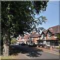
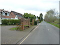
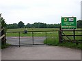
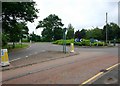
19 photos from this area
Area Information
Key information about the B37 7NR including its size, population, and administrative classification.
- Area Type
- Postcode
- Area Size
- 4813 m²
- Population
- 1485
- Population Density
- 6585 people/km²
House Prices in B37 7NR
19
Properties
£101,333
Average Sold Price
£32,000
Lowest Price
£196,500
Highest Price
Showing 19 properties
| Address | Type | Beds | Baths | Last Sale Price | Last Sale Date | |
|---|---|---|---|---|---|---|
| 49 Helmswood Drive, Chelmsley Wood, Solihull, B37 7NR | Flat | 2 | 1 | £102,500 | Oct 2025 | |
| 73 Helmswood Drive, Chelmsley Wood, Solihull, B37 7NR | house | 2 | 1 | £196,500 | Dec 2022 | |
| 69 Helmswood Drive, Chelmsley Wood, Solihull, B37 7NR | house | - | - | £149,500 | Oct 2022 | |
| 45 Helmswood Drive, Chelmsley Wood, Solihull, B37 7NR | Maisonette | 1 | - | £93,000 | Apr 2007 | |
| 63 Helmswood Drive, Chelmsley Wood, Solihull, B37 7NR | Flat | - | - | £32,000 | Jun 2002 | |
| 67 Helmswood Drive, Chelmsley Wood, Solihull, B37 7NR | Terraced | - | - | £34,500 | Nov 1996 | |
| 59 Helmswood Drive, Chelmsley Wood, Solihull, B37 7NR | Flat | - | - | - | - | |
| 61 Helmswood Drive, Chelmsley Wood, Solihull, B37 7NR | Flat | - | - | - | - | |
| 77 Helmswood Drive, Chelmsley Wood, Solihull, B37 7NR | Flat | - | - | - | - | |
| 79 Helmswood Drive, Chelmsley Wood, Solihull, B37 7NR | Flat | - | - | - | - |
Page 1 of 2
Energy Efficiency in B37 7NR
Amenities
Schools
| Rank | School | Type | Entry gender | Ages |
|---|
Explore more schools in this area
Go to Schools tabDemographics
Household Size
One person
most common
Accommodation Type
Houses
most common
Tenure
40
majority
Ethnic Group
White
most common
Religion
N/A
most common
Household Composition
N/A
most common
Age
47
median
Adults (30-64 years)
most common
Household Deprivation
N/A
with no deprivation
NS-SEC
18
in Lower managerial occupations
Explore more demographic insights in this area
Go to Demographics tabPlanning
Planning Constraints
- Flood RiskPremium
- Ramsar Wetland SitesPremium
- Area of Outstanding Natural BeautyPremium
- Protected Nature ReservePremium
- Protected WoodlandPremium