Area Overview for B37 7EH
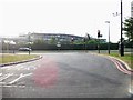
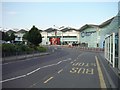
Photos of B37 7EH


Area Information
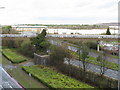
Living in B37 7EH means inhabiting a small, tightly knit residential cluster in the heart of the West Midlands. This postcode area, encompassing parts of Bickenhill and Marston Green, sits on the eastern edge of the region, straddling the A45 road and bordered by Birmingham Airport and the National Exhibition Centre. With a population of 1,661 spread across 137 people per square kilometre, it retains a quiet, suburban character despite its proximity to major infrastructure. The area’s history as a rural parish has given way to a mix of historic conservation zones and modern suburban development. Bickenhill village, a designated Conservation Area with a “High” value, preserves its medieval church and narrow lanes, while Marston Green evolved into a leafy suburb in the 1930s. Daily life here balances proximity to transport hubs with a sense of local heritage, making it appealing to those seeking a blend of convenience and tradition.
- Area Type
- Postcode
- Area Size
- Not available
- Population
- 1661
- Population Density
- 137 people/km²
The property market in B37 7EH is dominated by owner-occupied homes, with 83% of residents living in houses rather than flats or rental properties. This reflects a suburban, family-oriented housing stock, typical of areas with low population density and historical rural roots. The prevalence of houses over flats suggests limited high-rise development and a focus on detached or semi-detached homes, which aligns with the area’s conservation status and low-rise character. For buyers, this means a market skewed toward long-term investment rather than short-term rental opportunities. The small size of the postcode area and its proximity to major transport links like Birmingham Airport and the M42 motorway may make it attractive to commuters or those seeking affordable housing near infrastructure. However, the lack of detailed property price data means potential buyers should investigate local listings for current market trends.
House Prices in B37 7EH
No properties found in this postcode.
Energy Efficiency in B37 7EH
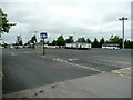
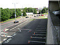
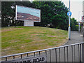
Residents of B37 7EH have access to a range of amenities within practical reach. Retail options include Asda Bickenhill, M&S Birmingham Airport SF, and Spar, catering to everyday needs. The area’s proximity to Birmingham International Airport and the M42 motorway enhances its appeal for those working in logistics or aviation. For leisure, the Conservation Area of Bickenhill offers historic charm, including St Peter’s Church, a 12th-century landmark, and the Marston Green Centenary Clock, a local icon. The nearby National Exhibition Centre and National Motorcycle Museum provide cultural and recreational opportunities. While parks and green spaces are not explicitly detailed, the area’s rural origins and conservation status suggest pockets of natural space. The mix of retail, transport, and heritage sites creates a lifestyle that balances convenience with a touch of historical character.
Amenities
Schools
| Rank | School | Type | Entry gender | Ages |
|---|
Explore more schools in this area
Go to Schools tabDemographics
The community in B37 7EH is predominantly composed of adults aged 30–64, with a median age of 47. This suggests a mature, stable population, likely drawn to the area’s established infrastructure and low land prices. Home ownership is high at 83%, indicating a strong preference for long-term residency over renting. The accommodation type is largely houses, reflecting a suburban layout rather than high-density living. The predominant ethnic group is White, though no specific data on diversity or deprivation levels is provided. This demographic profile suggests a community focused on family living and retirement, with fewer young families or transient populations. The absence of detailed diversity metrics means the area’s social dynamics remain largely unexplored in the data, but the high home ownership rate implies a cohesive, settled neighbourhood.
Household Size
Accommodation Type
Tenure
Ethnic Group
Religion
Household Composition
Age
Household Deprivation
NS-SEC
Explore more demographic insights in this area
Go to Demographics tabPlanning
Planning Constraints
- Flood RiskPremium
- Ramsar Wetland SitesPremium
- Area of Outstanding Natural BeautyPremium
- Protected Nature ReservePremium
- Protected WoodlandPremium