Area Overview for B37 7DX
Photos of B37 7DX


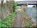
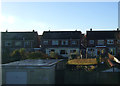

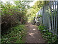


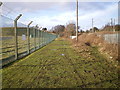
21 photos from this area
Area Information
Key information about the B37 7DX including its size, population, and administrative classification.
- Area Type
- Postcode
- Area Size
- 8.2 hectares
- Population
- 1661
- Population Density
- 137 people/km²
House Prices in B37 7DX
51
Properties
£199,121
Average Sold Price
£69,000
Lowest Price
£315,000
Highest Price
Showing 51 properties
| Address | Type | Beds | Baths | Last Sale Price | Last Sale Date | |
|---|---|---|---|---|---|---|
| 77 Digby Drive, Marston Green, Solihull, B37 7DX | house | - | - | £290,000 | Mar 2025 | |
| 58 Digby Drive, Marston Green, Solihull, B37 7DX | Semi-detached | 3 | 1 | £295,000 | Oct 2024 | |
| 70 Digby Drive, Marston Green, Solihull, B37 7DX | Semi-detached | 3 | 2 | £315,000 | Jun 2023 | |
| 61 Digby Drive, Marston Green, Solihull, B37 7DX | house | - | - | £286,000 | Jun 2022 | |
| 92 Digby Drive, Marston Green, Solihull, B37 7DX | house | - | - | £260,000 | May 2021 | |
| 106 Digby Drive, Marston Green, Solihull, B37 7DX | Bungalow | 2 | 1 | £260,000 | Mar 2021 | |
| 63 Digby Drive, Marston Green, Solihull, B37 7DX | Semi-detached | 3 | 1 | £245,000 | Oct 2020 | |
| 62 Digby Drive, Marston Green, Solihull, B37 7DX | Semi-detached | 3 | 1 | £262,000 | Mar 2020 | |
| 102 Digby Drive, Marston Green, Solihull, B37 7DX | Semi-detached | 3 | 1 | £244,280 | Jan 2020 | |
| 72 Digby Drive, Marston Green, Solihull, B37 7DX | Semi-detached | 3 | 1 | £250,000 | Nov 2019 |
Page 1 of 6
Energy Efficiency in B37 7DX
Amenities
Schools
| Rank | School | Type | Entry gender | Ages |
|---|
Explore more schools in this area
Go to Schools tabDemographics
Household Size
Family (3-5 people)
most common
Accommodation Type
Houses
most common
Tenure
83
majority
Ethnic Group
White
most common
Religion
N/A
most common
Household Composition
N/A
most common
Age
47
median
Adults (30-64 years)
most common
Household Deprivation
N/A
with no deprivation
NS-SEC
33
in Lower managerial occupations
Explore more demographic insights in this area
Go to Demographics tabPlanning
Planning Constraints
- Flood RiskPremium
- Ramsar Wetland SitesPremium
- Area of Outstanding Natural BeautyPremium
- Protected Nature ReservePremium
- Protected WoodlandPremium