Area Overview for B37 7DS
Photos of B37 7DS


Area Information
Living in B37 7DS means being part of a small, tightly knit residential cluster in the Metropolitan Borough of Solihull, straddling the A45 road between Birmingham and Coventry. The area, known as Bickenhill and Marston Green, blends suburban comfort with historical roots. With a population of 1,661 and a low density of 137 people per square kilometre, it offers a quieter alternative to nearby urban centres. The parish includes Birmingham Airport, the National Exhibition Centre, and the National Motorcycle Museum, creating a dynamic backdrop to everyday life. Historically a rural area, it transitioned to a suburban hub in the 20th century, with Marston Green developing as a leafy residential zone in the 1930s. Today, the area retains pockets of conservation value, including Bickenhill’s grade 1 listed church and the Marston Green Centenary Clock. Residents benefit from proximity to major transport routes like the M42 and A45, while the village core remains a focal point for community life.
- Area Type
- Postcode
- Area Size
- Not available
- Population
- 1661
- Population Density
- 137 people/km²
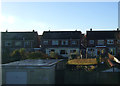
The property market in B37 7DS is dominated by owner-occupied homes, with 83% of properties in private hands. The area’s accommodation type is primarily houses, reflecting its suburban and rural character. This contrasts with high-density urban areas, where flats are more common. As a small postcode area, the housing stock is limited, meaning buyers should consider the broader Solihull region for more options. The predominance of houses suggests a focus on family homes, with potential for larger properties compared to city centres. However, the small size of the postcode means competition for available properties could be fierce. Prospective buyers should also consider proximity to major infrastructure like Birmingham Airport and the NEC, which may influence property values and desirability.
House Prices in B37 7DS
No properties found in this postcode.
Energy Efficiency in B37 7DS
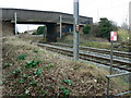
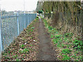
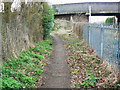
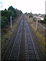
Daily life in B37 7DS is shaped by its proximity to retail, transport, and historical sites. Nearby shops include Spar, M&S Birmingham Airport, and Co-op Church, offering convenience for essentials. The area’s transport links are a key feature, with Birmingham International Airport and railway stations providing easy access to major cities and employment hubs. The village retains a rural character, with Bickenhill’s conservation area and Marston Green’s Centenary Clock adding to its charm. While the area lacks large parks, its low density means open spaces are more accessible. The presence of the National Exhibition Centre and Birmingham Airport introduces a dynamic element, with events and jobs influencing the local economy. Residents benefit from a balance of suburban tranquillity and proximity to urban amenities.
Amenities
Schools
| Rank | School | Type | Entry gender | Ages |
|---|
Explore more schools in this area
Go to Schools tabDemographics
The population of B37 7DS is predominantly middle-aged, with a median age of 47 and the largest age group being adults aged 30–64. Over 83% of homes are owner-occupied, reflecting a stable, long-term community. The area is characterised by houses rather than flats, aligning with its suburban and rural heritage. The predominant ethnic group is White, though no specific data on diversity or deprivation is provided. The population density of 137 people per square kilometre suggests a spacious, low-rise living environment. This demographic profile indicates a community focused on family living and long-term residency, with limited turnover. The age range suggests a mix of established professionals and retirees, contributing to a mature, settled neighbourhood.
Household Size
Accommodation Type
Tenure
Ethnic Group
Religion
Household Composition
Age
Household Deprivation
NS-SEC
Explore more demographic insights in this area
Go to Demographics tabPlanning
Planning Constraints
- Flood RiskPremium
- Ramsar Wetland SitesPremium
- Area of Outstanding Natural BeautyPremium
- Protected Nature ReservePremium
- Protected WoodlandPremium