Area Overview for B37 7AU
Photos of B37 7AU


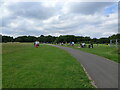
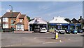

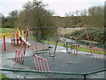
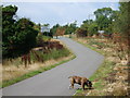
33 photos from this area
Area Information
Key information about the B37 7AU including its size, population, and administrative classification.
- Area Type
- Postcode
- Area Size
- 4917 m²
- Population
- 1892
- Population Density
- 2763 people/km²
House Prices in B37 7AU
10
Properties
£307,500
Average Sold Price
£240,000
Lowest Price
£375,000
Highest Price
Showing 10 properties
| Address | Type | Beds | Baths | Last Sale Price | Last Sale Date | |
|---|---|---|---|---|---|---|
| 52 Station Road, Marston Green, Solihull, B37 7AU | Bungalow | 3 | 2 | £375,000 | Dec 2023 | |
| 36 Station Road, Marston Green, Solihull, B37 7AU | house | - | - | £240,000 | Jun 2004 | |
| Flat Over, 48B Station Road, Marston Green, Solihull, B37 7AU | Flat | - | - | - | - | |
| Annex At, 36 Station Road, Marston Green, Solihull, B37 7AU | Flat | - | - | - | - | |
| 48B Station Road, Marston Green, Solihull, B37 7AU | Flat | - | - | - | - | |
| 46 Station Road, Marston Green, Solihull, B37 7AU | Detached | - | - | - | - | |
| 34 Station Road, Marston Green, Solihull, B37 7AU | Bungalow | - | - | - | - | |
| Evans Derry Solicitors, 30 Station Road, Marston Green, Solihull, B37 7AU | office_workshop | - | - | - | - | |
| The Hospice Charity Partnership, 32 Station Road, Marston Green, Solihull, B37 7AU | retail_financial | - | - | - | - | |
| Franklin & Hawkins Independent Family Funeral Directors, 50 Station Road, Marston Green, Solihull, B37 7AU | Flat | - | - | - | - |
Energy Efficiency in B37 7AU
Amenities
Schools
| Rank | School | Type | Entry gender | Ages |
|---|
Explore more schools in this area
Go to Schools tabDemographics
Household Size
Family (3-5 people)
most common
Accommodation Type
Houses
most common
Tenure
79
majority
Ethnic Group
White
most common
Religion
N/A
most common
Household Composition
N/A
most common
Age
47
median
Adults (30-64 years)
most common
Household Deprivation
N/A
with no deprivation
NS-SEC
34
in Lower managerial occupations
Explore more demographic insights in this area
Go to Demographics tabPlanning
Planning Constraints
- Flood RiskPremium
- Ramsar Wetland SitesPremium
- Area of Outstanding Natural BeautyPremium
- Protected Nature ReservePremium
- Protected WoodlandPremium