Area Overview for B37 6RN
Photos of B37 6RN

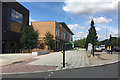

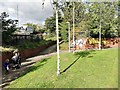
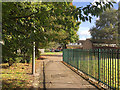
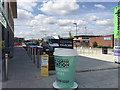
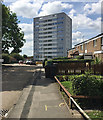
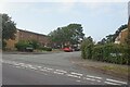
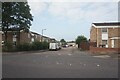
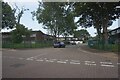


35 photos from this area
Area Information
Key information about the B37 6RN including its size, population, and administrative classification.
- Area Type
- Postcode
- Area Size
- 2.8 hectares
- Population
- Not available
- Population Density
- Not available
House Prices in B37 6RN
45
Properties
£87,914
Average Sold Price
£33,500
Lowest Price
£212,000
Highest Price
Showing 45 properties
| Address | Type | Beds | Baths | Last Sale Price | Last Sale Date | |
|---|---|---|---|---|---|---|
| 52 Woodlands Way, Chelmsley Wood, Solihull, B37 6RN | Flat | - | - | £117,000 | Dec 2024 | |
| 68 Woodlands Way, Chelmsley Wood, Solihull, B37 6RN | Flat | - | - | £95,000 | Mar 2023 | |
| 101 Woodlands Way, Chelmsley Wood, Solihull, B37 6RN | Flat | - | - | £106,000 | Dec 2021 | |
| 79 Woodlands Way, Chelmsley Wood, Solihull, B37 6RN | Terraced | 3 | - | £160,000 | Sep 2021 | |
| 44 Woodlands Way, Chelmsley Wood, Solihull, B37 6RN | house | - | - | £212,000 | Nov 2020 | |
| 71 Woodlands Way, Chelmsley Wood, Solihull, B37 6RN | Flat | 2 | 1 | £90,000 | Apr 2019 | |
| 73 Woodlands Way, Chelmsley Wood, Solihull, B37 6RN | Flat | 2 | - | £92,000 | Mar 2019 | |
| 50 Woodlands Way, Chelmsley Wood, Solihull, B37 6RN | Flat | - | - | £72,000 | Sep 2017 | |
| 105 Woodlands Way, Chelmsley Wood, Solihull, B37 6RN | Flat | 2 | 1 | £88,000 | Sep 2017 | |
| 56 Woodlands Way, Chelmsley Wood, Solihull, B37 6RN | Flat | - | - | £87,000 | Jul 2017 |
Page 1 of 5
Energy Efficiency in B37 6RN
Amenities
Schools
| Rank | School | Type | Entry gender | Ages |
|---|
Explore more schools in this area
Go to Schools tabDemographics
Household Size
One person
most common
Accommodation Type
Houses
most common
Tenure
37
majority
Ethnic Group
White
most common
Religion
N/A
most common
Household Composition
N/A
most common
Age
47
median
Adults (30-64 years)
most common
Household Deprivation
N/A
with no deprivation
NS-SEC
18
in Lower managerial occupations
Explore more demographic insights in this area
Go to Demographics tabPlanning
Planning Constraints
- Flood RiskPremium
- Ramsar Wetland SitesPremium
- Area of Outstanding Natural BeautyPremium
- Protected Nature ReservePremium
- Protected WoodlandPremium